Arktika-M
EO
Atmosphere
Ocean
Cloud type, amount and cloud top temperature
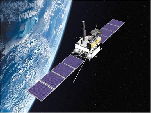
Launched in February 2021, Arktika-M N1 is the first of two satellites part of the Arktika-M mission whose operation is led by the Russian Federal Space Agency (ROSCOSMOS) and assisted by the Russian Federal Service for Hydrometeorology and Environmental Monitoring (ROSHYDROMET). The entire constellation, which is planned to be fully operational by 2025, aims to monitor the Earth’s atmosphere and surface in the Arctic, collect and relay information from Arctic facilities, monitor cosmic rays, and assist in the international search and rescue service, COSPAR-SARSAT.
Quick facts
Overview
| Mission type | EO |
| Agency | ROSKOSMOS, ROSHYDROMET |
| Mission status | Operational (nominal) |
| Launch date | 28 Feb 2021 |
| Measurement domain | Atmosphere, Ocean, Land, Gravity and Magnetic Fields, Snow & Ice |
| Measurement category | Cloud type, amount and cloud top temperature, Liquid water and precipitation rate, Atmospheric Temperature Fields, Radiation budget, Multi-purpose imagery (land), Surface temperature (land), Vegetation, Gravity, Magnetic and Geodynamic measurements, Surface temperature (ocean), Atmospheric Humidity Fields, Ozone, Snow cover, edge and depth, Atmospheric Winds |
| Measurement detailed | Cloud top height, Downward long-wave irradiance at Earth surface, Cloud cover, Precipitation intensity at the surface (liquid or solid), Cloud type, Cloud imagery, Fire fractional cover, Magnetic field (scalar), Magnetic field (vector), Short-wave Earth surface bi-directional reflectance, Atmospheric specific humidity (column/profile), O3 Mole Fraction, Land surface temperature, Sea surface temperature, Snow cover, Cloud top temperature, Normalized Differential Vegetation Index (NDVI), Wind profile (horizontal), Atmospheric stability index |
| Instruments | GGAK-VE, MSU-GS/VE |
| Instrument type | Imaging multi-spectral radiometers (vis/IR), Space environment |
| CEOS EO Handbook | See Arktika-M summary |
Summary
Mission Capabilities
Arktika-M N1 has four instruments onboard, a multispectral scanning imager-radiometer (MSU-GS), a magnetometer (FM-VE), a radiation spectrometer (SKIF-VE), and a cosmic ray detector (GALS-VE). and a module for geophysical measurements (GGAK-VE). FM-VE measures the Earth’s magnetic field, SKIF-VE measures the energy of electrons and protons bound from Earth, GALS-VE measures the energy of protons bound for Earth, and these three instruments are all part of a larger module for geophysical measurements (GGAK-VE).
Performance Specifications
MSU-GS observes over 10 bands: two visual (VIS), one near-infrared (NIR), one mid-wave infrared (MWIR), and six thermal infrared (TIR). It has a swath width equivalent to the full earth disk, and has a spatial resolution of 1 km for the VIS bands and 4 km for the IR bands. FM-VE has an accuracy of 0.06 nT, and SKIF-VE can make energy flux measurements in the ranges 0.15 - 1.0 MeV for electrons and 0.85 - 150 MeV for protons. GALS-VE has three channels depending on the flux density of protons: > 600 MeV, > 800 MeV, and > 1200 MeV.
Arktika-M N1 undertakes a specific highly eccentric orbit (HEO) with an inclination of 63.4° and an argument of perigee of 270°, a Molniya orbit. It has an apogee of 39750 km, a perigee of 1043 km, and a period of half a sidereal day (approximately 11 hours and 58 minutes).
Space and Hardware Components
The 2200 kg Arktika-M N1 satellite was launched aboard a Soyuz-2 launch vehicle from the Baikonur Cosmodrome in Kazakhstan.
Arktika-M N2 is expected to launch in 2023. Arktika-M is a subdivision of the larger Arktika mission that comprises 10 satellites in total: the two of Arktika-M, the three commercial satellites of Arktika-MS1, the three communication and GPS satellites of Arkitka-MS2, and the two remote sensing satellites of Arktika-R.
Overview
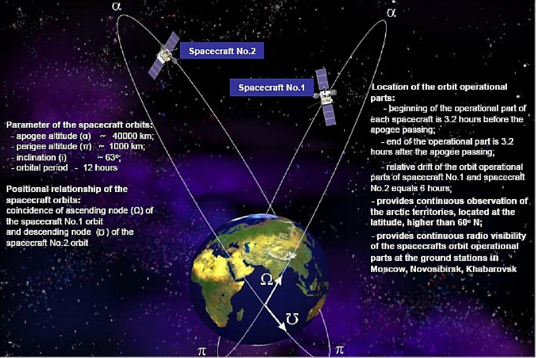
Arktika-M is a Russian polar meteorological mission proposed and operated by the Russian Federal Space Agency (ROSCOSMOS) and assisted by the Russian Federal Service for Hydrometeorology and Environmental Monitoring (ROSHYDROMET). The project definition phase started in 2007. The scenario involves two satellites in HEO (Highly Elliptical Orbit - i.e., Molniya-type orbits) with an inclination of 63.4°, and an orbital period of approximately 12 hours. This configuration would allow a quasi-permanent coverage of high-latitude areas for weather, ice and snow monitoring as well as for telecommunications and data collection. 1) 2)
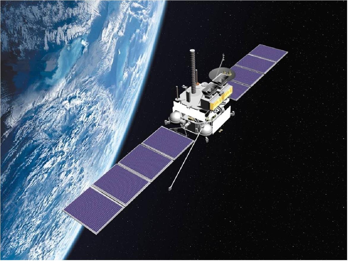
Major errors in statistical weather forecasts can be explained by initial data discrepancies. Most initial weather data for the Arctic regions comes from international geostationary satellites, which cannot effectively scan the Earth's high latitudes. Their angles of observation do not exceed ±70°, meaning they cannot effectively observe higher than ±60° of latitude. However, a quasi-static Molniya system is ideally suited for feature tracking in polar regions and fully complements the data obtained from geostationary satellites. 3)
The Arktika system concept is capable of monitoring the weather and environment of the North Pole, pinpointing hydrocarbon deposits on the Arctic shelf, providing telecommunications over the hard-to-access areas and ensuring safe air traffic and commercial shipping in the region. The vast hydrocarbon deposits that will become more accessible as rising global temperatures lead to a reduction in sea ice have brought the Arctic to the centre of geopolitical wrangling between the United States, Russia, Canada, Norway, and Denmark.
The Arktika mission is planned to eventually comprise 10 Earth-orbiting satellites: the two of Arktika-M, the three commercial satellites of Arktika-MS1, the three communication and GPS satellites of Arkitka-MS2, and the two remote sensing satellites of Arktika-R. The advantage of this approach is to have full-time coverage of the polar regions which is currently not provided by the GEO satellites).
The Arktika program is supported by the Russian Economic Development Ministry. In 2010, the ministry examined the Roskosmos proposals and deemed the program necessary to create such a system, and has now proposed to the government that Arktika be introduced from 2014 onwards. 4) 5) 6)
Russia plans to make Arktika an international cooperative program. The WMO (World Meteorological Organization) encourages the space agencies of the world to participate in the Arktika mission.

The mission objectives are
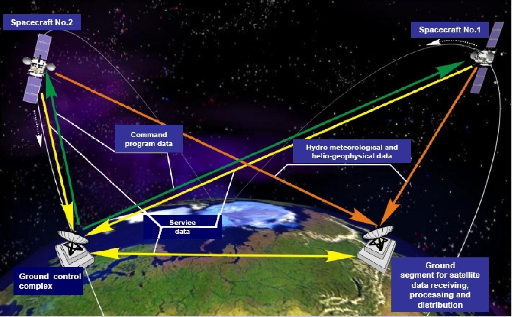
• Monitoring of the Earth's atmosphere and surface in Arctic regions (inaccessible for observation from geostationary orbit) on the basis of multispectral imaging with high temporal resolution (15 - 30 min).
• Provision of heliogeophysical information in polar areas
• Maintaining data collection system, and telecommunication service for data exchange and retransmission
• Search & Rescue service (COSPAS-SARSAT)
Spacecraft
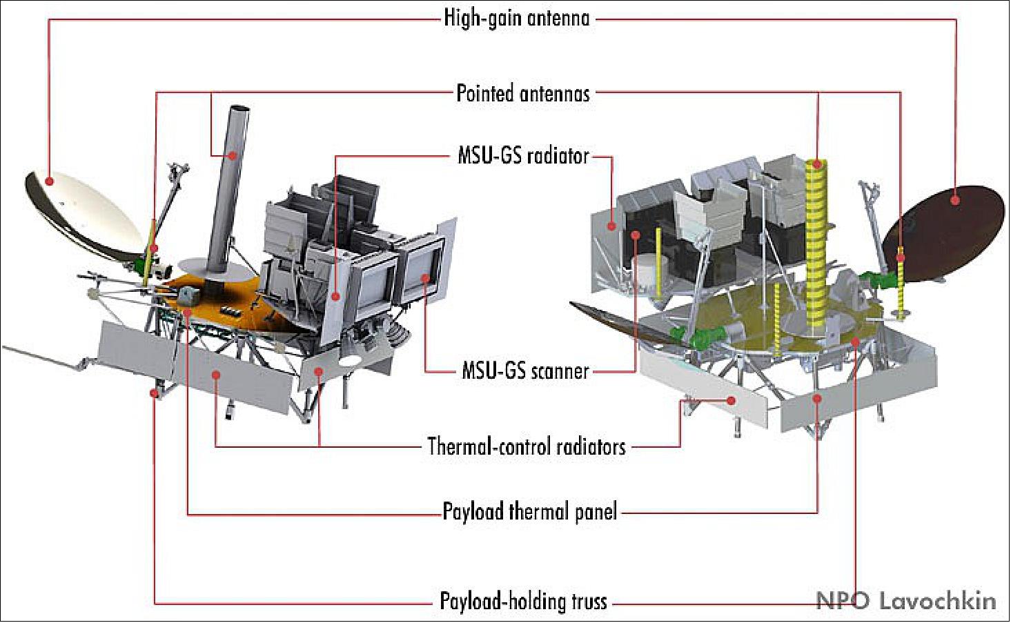
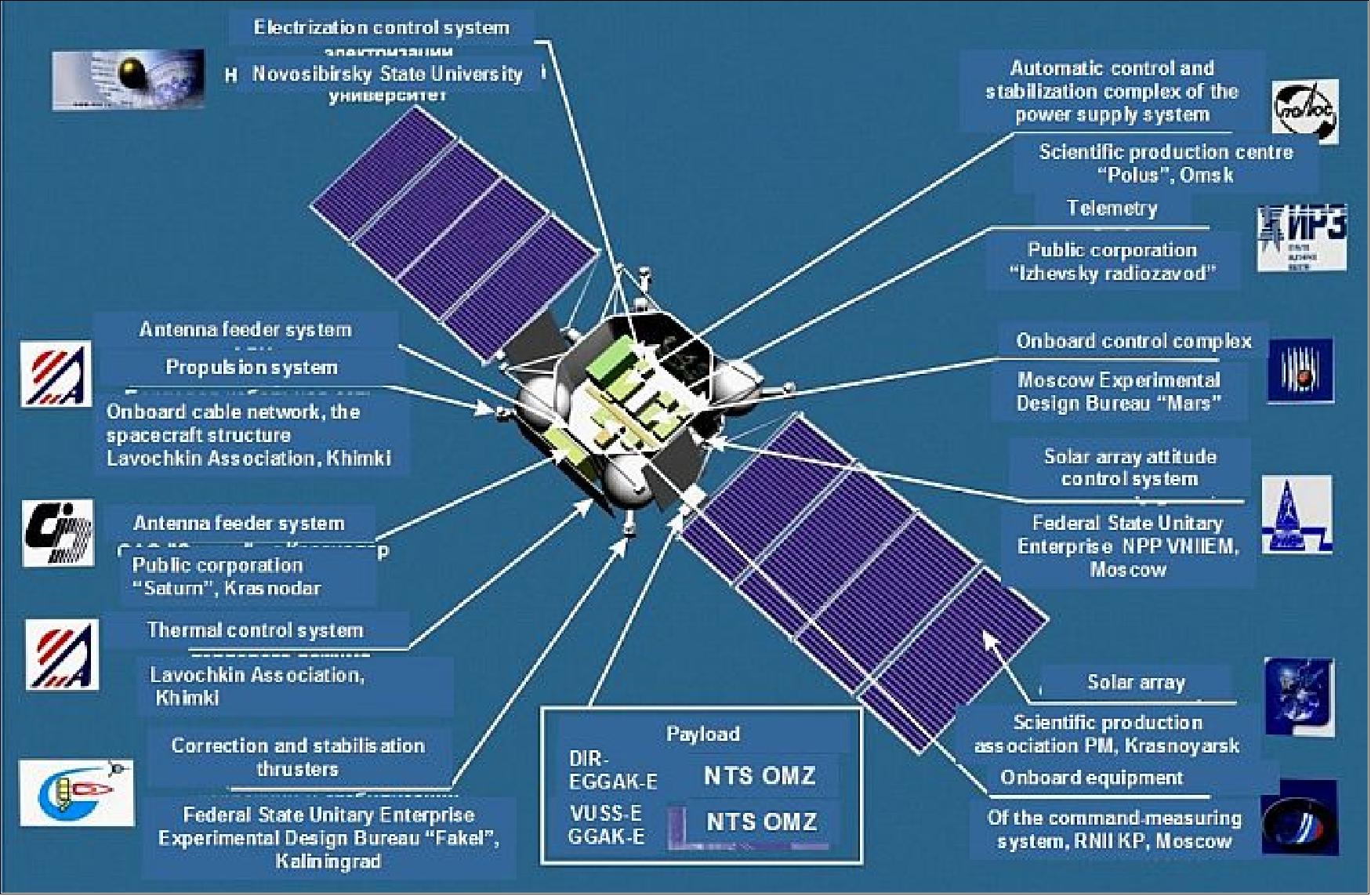
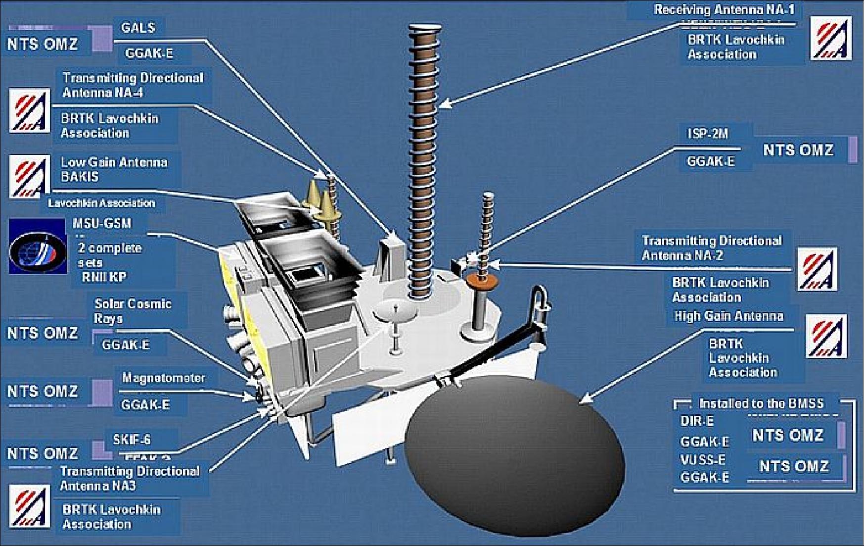
The Arktika-M N1 spacecraft consists of two main components: the Navigator Service Module, also known as Base Module of Service Systems, BMSS, and the payload module. The BMSS was a modified version of the one aboard the Elektro-L3 satellite. The Elektro-L3 satellite served as a basis for the Arktika-M satellites. One larger difference between the two is that Arktika-M N1 is equipped with a pair of solar panels instead of a single array installed on the Elektro-L series. Additionally, the electronics aboard Arktika-M N1 had to be more resistant to radiation because its orbit passed through the Van Allen radiation belts.
System | BMSS for Arktika-M | BMSS for Elektro-L |
Onboard Flight Control System | Star tracker 348K Astro-coordinator SED26 Two SDP-1 KUDM Agat-40S KIND 34-020-01 BVU-0 BUK-A BU3-A BU4-A BU5-A BU6-A BU7-A | Star tracker 348K Astro-coordinator SED26 Two SDP-1 KUDM Agat-40S KIND 34-020-01 BVU-0 BUK 1-1 BU3 BU4 BU5 BU6 BU7 |
Power Supply System | Rechargeable battery, AB, ZONV-70 ZRU-E USK-E Two solar panels (GaAs) | Rechargeable battery, AB, ZONV-70 ZRU-E USK-E One solar panel (GaAs) |
Propulsion System | DBS DBK Pressurisation Unit Spherical Tank Two tanks Two compensators | DBS DBK Pressurisation Unit Spherical Tank Three tanks Three compensators |
Telemetry System | BM ARM MSS ARM | BM MSS |
Command and Measurement System | Three SHa1053M Sha874-10B Three UM3334-10 LA009 | Three SHa1053M Sha874-10B Three UM3334-10 LA009 |
Antenna System | AFU | AFU |
Solar Panel Orientation System | Two E15 Two E16 | One E15 One E16 |
Autonomous Navigation System | AFU BE | AFU ARN |
Electrical Control System | Six DEP-AD BE | Six DEP-AD BE |
Launch
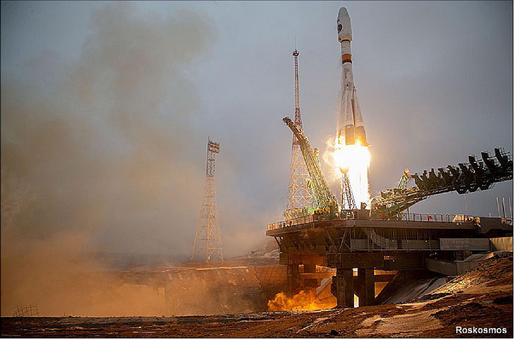
Russian personnel at the Baikonur Cosmodrome in Kazakhstan performed an inaugural launch of the Arktika-M No 1 meteorological and remote-sensing satellite on February 28, 2021, at 09:55 Moscow time (06:55 UTC). 7)
Orbit: Arktika-M N1 undertakes a specific highly eccentric orbit (HEO) with an inclination of 63.4° and an argument of perigee of 270°, a Molniya orbit. It has an apogee of 39750 km, a perigee of 1043 km, and a period of half a sidereal day (approximately 11 hours and 58 minutes).
Spacecraft Designation | Arktika-M N1 |
Launch Date and Time | February 28, 2021, at 09:55 Moscow time (06:55 UTC) |
Spacecraft Launch Mass | 2,200 kg |
Spacecraft Prime Developer | NPO Lavochkin |
Launch Vehicle | Soyuz-2-1b No.15000-032 |
Payload Fairing | 81KS 1000-0 No.G15000-028 |
Launch Site | Baiknour, Site 31 |
Target Orbit | Apogee: 3950 km; Perigee: 1043 km; Inclination 63.4° |
Mission Status
● October 25, 2022: Speaking during a meeting at the Vostochny spaceport, the deputy prime minister of Russia, Yury Trutnev, confirmed another Arktika-M satellite will be launched into the Arctic orbit to provide hydro-meteorology data from the region. Another three satellites, including two Kondor-FKAs and a single Obzor-R will be sent up for radar surveillance purposes. All five are expected to be operational by 2024.
● September 3, 2021: A meeting of the state commission was held to review the results of flight tests of Arktika-M with the spacecraft Arktika-M N1. The State Commission decided to complete the flight tests.
● March 22, 2021: Arktika-M N1 received and transmitted to Earth the first images of the Arctic region as part of flight tests.
● February 28, 2021: Arktika-M N1 satellite was launched aboard a Soyuz-2 launch vehicle at 09:55 Moscow Time (06:55 UTC) from the Baikonur Cosmodrome in Kazakhstan.
● October 2020: ROSKOSMOS announces that the Arktika-M N1 satellite will be launched in early 2021.
● September 14, 2020: Russian news agency, RIA Novosti, reports that the launch is postponed until December 24, 2020.
● Mid-2018: ROSKOSMOS announces that the first launch will be pushed to the third or fourth quarter of 2020 due to delays with the launch of the Elektro-L N3 satellite.
● April 2018: The Moscow-based RKS Corporation announced that it had completed the production of the MSU-GS scanning device for the first Arktika satellite and transferred it to NPO Lavochkin.
● December 9, 2016: The project was extended by a new contract No.361-4927/16/311
● August 22, 2012: The development of the first Arktika satellite was formally authorised by ROSKOSMOS in a contract No.361-4927/12
● August 16, 2010: Anatoly Perminov, the head of ROSKOSMOS announced that "We developed a system that consists of three subsystems, and submitted our proposals [for the Arktika mission] to the Economic Development Ministry. The ministry examined them and deemed it necessary to create such a system, and has now proposed to the government that [Arktika] be introduced from 2014”.
Sensor Complement
The equipment installed on the Arktika-M N1 satellite is similar to that of the Elektro-L second-generation geostationary weather satellites. The main instruments onboard are the multispectral scanning imager-radiometer (MSU-GS) and those within the module for geophysical measurements (GGAK-VE).
Instrument | Payloads aboard Arktika-M | Payloads aboard Elektro-L |
MSU-GS (Multispectral scanning imager-radiometer) | EA241M | EA241M |
BSSD-VE (Onboard Data Gathering System) | EA252 | EA252 |
GGAK-VE (Module for Geophysical Measurements) | FM-VE SKIF-VE GALS-VE | FM-VE SKIF-VE GALS-VE DIR-E VUSS-E |
ONA (High-Gain Antenna Ponting System) | One ONA mechanism | Two ONA mechanisms |
Onboard Radio Complex | BRTK-VE AFS BRTK-VE BRTR-VE | BRTK-E AFS BRTK BRTR-E |
MSU-GS (Multispectral Scanning Imager-Radiometer)
MSU-GS observes over 10 bands: two visual (VIS), one near-infrared (NIR), one mid-wave infrared (MWIR), and six thermal infrared (TIR). It has a swath width equivalent to the full earth disk, and has a spatial resolution of 1 km for the VIS bands and 4 km for the IR bands.
Band Type | Band Wavelengths |
VIS | 0.5 - 0.65 µm 0.65 - 0.8 µm |
NIR | 0.8 - 0.9 µm |
MWIR | 3.5 - 4.01 µm |
TIR | 5.7 - 7.0 µm 7.5 - 8.5 µm 8.2 - 9.2 µm 9.2 - 10.2 µm 10.2 - 11.2 µm 11.2 - 12.5 µm |
GGAK-VE: FM-VE (Magnetometer)
FM-VE measures the magnetic field vector at its current position with an accuracy of 0.06 nT.
GGAK-VE: SKIF-VE (Radiation Spectrometer)
The spectrometer can make energy flux measurements in the ranges 0.15 - 1.0 MeV for electrons and 0.85 - 150 MeV for protons.
GGAK-VE: GALS-VE (Cosmic Ray Detector)
GALS-VE measures the energy of protons bound for Earth by categorising them into one of three channels depending on the flux density of protons: > 600 MeV, > 800 MeV, and > 1200 MeV.
References
1) "High-elliptical Orbits Satellite System Arctica" URL: https://web.archive.org/web/20140529225244/http://bprc.osu.edu/rsl/GIIPSY/documents/Pres%20Ark%20Eng%20Vers%204.ppt
2) A. B. Uspensky, “Status of current and future Roshydrometsatellite programmes,” ITSC-16 (16th International TOVS Study Conference), Angra dos Reis, Brazil, May 07 –13, 2008, URL: http://cimss.ssec.wisc.edu/itwg/itsc/itsc16/presentations/11_06_uspensky.pdf
3) Yury Zaitsev, “Outside View: Arctic satellite balance,” Space Mart, Dec. 26, 2007, URL: http://www.spacemart.com/reports/Outside_View_Arctic_satellite_balance_999.html
4) “Russia Proposes Launch Of Arktika Space Monitoring Project In 2014,” Space Daily, Aug.17, 2010, URL: http://www.spacedaily.com/reports/Russia_Proposes_Launch_Of_Arktika_Space_Monitoring_Project_In_2014_999.html
5) Lars Peter Riishojgaard, “The Molniya Orbit Imager - a high-latitude quasi-geostationary satellite mission,” Arctic Imaging Workshop, NBI (Niels Bohr Institute), Copenhagen, Denmark, August 20-21, 2008.
6) Vladimir Krovotyntsev, “Perspectives of Development of the Russian Meteorological Satellite Constellation,” 10th Meeting of the International Ice Charting Working Group,” Geneva, Switzerland, Oct. 12-16, 2009, URL: https://web.archive.org/web/20150121121758/http://nsidc.org/noaa/iicwg/presentations/IICWG_2009/Krovotyntsev_Russian_Met_Satellite_Constellation.pdf
7) Anatoly Zak, ”Soyuz launches first Arktika-M satellite,” Russian Space Web, 28 February 2021, URL: https://www.russianspaceweb.com/arktika_m1.html
8) Gabrielle Petrauskaite, “Russia’s Roscosmos plans to launch 9 satellites into Arctic orbit by 2026”, Aerotime Hub, October 26, 2022, URL: https://www.aerotime.aero/articles/32505-roscosmos-plans-to-launch-9-satellites-arctic-orbit-by-2026