Harmony A and B (Earth Explorer 10A and 10B)
EO
ESA
Atmosphere
Ocean
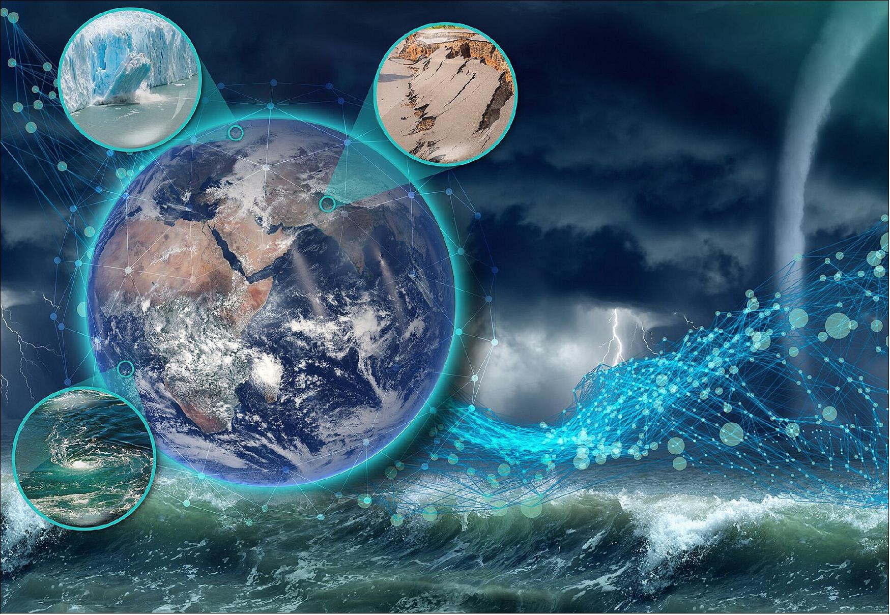
Harmony is a constellation of two SAR (Synthetic Aperture Radar) equipped satellites operated by the European Space Agency (ESA) as an Earth Explorer mission, which will run in tandem with a Sentinel-1 satellite. Until their design life of five years comes to an end, they will monitor changes in the Earth’s surface, as well as monitor ocean surface conditions such as wind, currents, and temperature.
Quick facts
Overview
| Mission type | EO |
| Agency | ESA |
| Mission status | Approved |
| Measurement domain | Atmosphere, Ocean, Gravity and Magnetic Fields, Snow & Ice |
| Measurement category | Atmospheric Temperature Fields, Gravity, Magnetic and Geodynamic measurements, Surface temperature (ocean), Sea ice cover, edge and thickness |
| Measurement detailed | Cloud base height, Sea surface temperature, Glacier motion, Crustal Motion, Sea-ice motion |
| Instruments | Multiview Thermal-Infared, Passive Synthetic Aperture Radar |
| Instrument type | Imaging multi-spectral radiometers (vis/IR), Imaging microwave radars |
| CEOS EO Handbook | See Harmony A and B (Earth Explorer 10A and 10B) summary |

Summary
Mission Capabilities
Each Harmony satellite will carry two instruments. The primary instrument is a receive-only C-band SAR (Synthetic Aperture Radar) that will detect C-band radio waves emitted from the SAR of a Sentinel-1 satellite. This data will be used to measure small changes in Earth’s surface that occur during events such as earthquakes and volcanic eruptions, thereby contributing to the assessment of geohazards. Changes in Earth’s surface also occur due to glacial flow, which will be studied to better understand the relationship between ice mass loss and the rising sea levels. The SAR measurements will also be used to monitor ocean surface conditions such as wind and currents to improve our knowledge and models of the ocean and thus improve forecasting.
The secondary instrument is a multibeam thermal-infrared instrument. When clouds are present, it will measure vertically-resolved cloud movement. When clouds are not present, the instrument will measure the ocean surface temperature to complement the data collected by the SAR.
Performance Specifications
The combined use of both SARs will allow the ocean surface currents to be measured with an accuracy of ±0.2 m/s.
The Harmony satellites will undertake the same orbit as the Sentinel-1 satellites. The orbit is sun-synchronous at an altitude of 693 km and an inclination of 98.19°. It has a period of 98.74 minutes and a repeat cycle of 12 days.
Space and Hardware Components
The Harmony satellites can orbit in two different formations, stereo and cross-track. In stereo formation, Harmony A will be 350 km behind the Sentinel-1 satellite, and Harmony B will be 350 km in front of the Sentinel-1 satellite. In cross-track formation, the Harmony satellites will orbit next to each other (~ 500 m separation), and 350 km behind the Sentinel-1 satellite. The choice of formation will depend on what is being observed.
Harmony (Earth Explorer 10)
Overview
Harmony is a constellation of two SAR (Synthetic Aperture Radar) equipped satellites operated by the European Space Agency (ESA) as an Earth Explorer mission, which will run in tandem with Sentinel-1.
The Earth Explorer missions are research missions that are applying new observation techniques to respond to the needs of the scientific community in their quest to understand different aspects of the Earth system and the interactions that bind the system as a whole. Advancing science and technology, they address questions that have a direct bearing on societal issues such as the availability of food, water, energy and resources, public health and climate change.
The Harmony concept comprises two identical C-band satellites that fly in in a configurable formation alongside a Copernicus Sentinel-1 satellite, which serves as an illuminator. Each Harmony satellite is designed to carry a receive-only synthetic aperture radar (SAR) instrument as its main payload. Flying additional radar receivers in a close formation enables new observation capabilities, revealing finer details and insights of the Earth's surface. In addition the mission will include a compact thermal infrared (TIR) camera. Working together with Sentinel-1’s radar, Harmony would provide data to measure small shifts in the shape of the land surface such as those related to earthquakes and volcanic activity, thereby contributing to risk monitoring. It would also allow for the study of 3D deformation and flow dynamics of glaciers at the rapidly changing marginal zones of the ice sheets for a better understanding of sea-level rise.
Both Harmony satellites would also carry a multiview thermal-infrared instrument, which in the presence of clouds will enable the measurement of height-resolved cloud movements. In absence of clouds, this multibeam thermal-infrared instrument will measure sea-surface temperature differences.
Harmony enables unique measurements over timescales ranging from tens of milliseconds to years, enabling the study of dynamic phenomena ranging from ocean currents to solid Earth surface motion.
Harmony would also be the first mission to provide data to improve our understanding of interactions between the air and the ocean surface by providing simultaneous measurements of wind, waves, and currents, that together with measurements of sea surface thermal differences and cloud motion will enable an unprecedented view of the marine atmospheric boundary layer.
Over land, Harmony would provide data to measure small shifts in the shape of the land surface, such as those resulting from earthquakes and volcanic activity, and therefore it will contribute to risk monitoring. It would also provide new information to study 3D deformation and flow dynamics of glaciers at the rapidly changing marginal zones of the ice sheets for a better understanding of the impact of ice mass loss on sea-level rise.
In essence, Harmony addresses key science questions in several domains. Its observation concept enables unique measurements over timescales ranging from tens of milliseconds (to measure ocean currents) to years (to measure solid Earth surface motion).
Spacecraft
In stereo formation, the Harmony satellites will be positioned at 350 km in front of and behind the Sentinel-1 satellite. In close flight formation, both Harmony satellites will fly relatively close to one another, approximately 200 - 500 metres apart, and at a distance of 350 km from the Sentinel-1 satellite.

Launch
Orbit: The Harmony satellites will undertake the same orbit as Sentinel-1. The orbit is sun-synchronous with an altitude of 693 km and an inclination of 98.19°. It has a period of 98.74 minutes and a repeat cycle of 12 days.
Harmony will alternate between two flying configurations:
- A close-formation configuration focused on single-pass cross-track interferometric measurements.
- A so-called stereo configuration, during which one of two spacecraft, Harmony-A (Concordia), will fly in the order of 300 km ahead of Sentinel-1, while the other, Harmony-B (Discordia), will fly roughly at about the same distance behind Sentinel-1. This maximizes the line-of-sight (LoS) diversity, hereby providing the best sensitivity to motion-vectors. 6)
Mission Status
• October 2024: The Harmony contract was signed with OHB in Germany to build ESA’s two Harmony Earth Explorer satellites. 7)
• September 2022: The Harmony candidate mission concept was formally selected as the tenth Earth Explorer, the mission is part of ESA’s Earth Observation FutureEO programme proposal at the Programme Board for the Observation, with funding approved by the Council at Ministerial Level, CM22. 4) 5)
Sensor Complement
Each Harmony satellite will carry a passive SAR (Synthetic Aperture Radar) instrument as its primary payload. These will capture the reflections of signals sent by Sentinel-1 to Earth. A multibeam thermal infrared camera will also be on board each satellite. These will measure the height and motion of clouds. Through the interaction between the three satellites, the deformation of Earth's surface in three dimensions will be measured and the speed of ocean currents will be determined with an accuracy of 0.2 m/s.
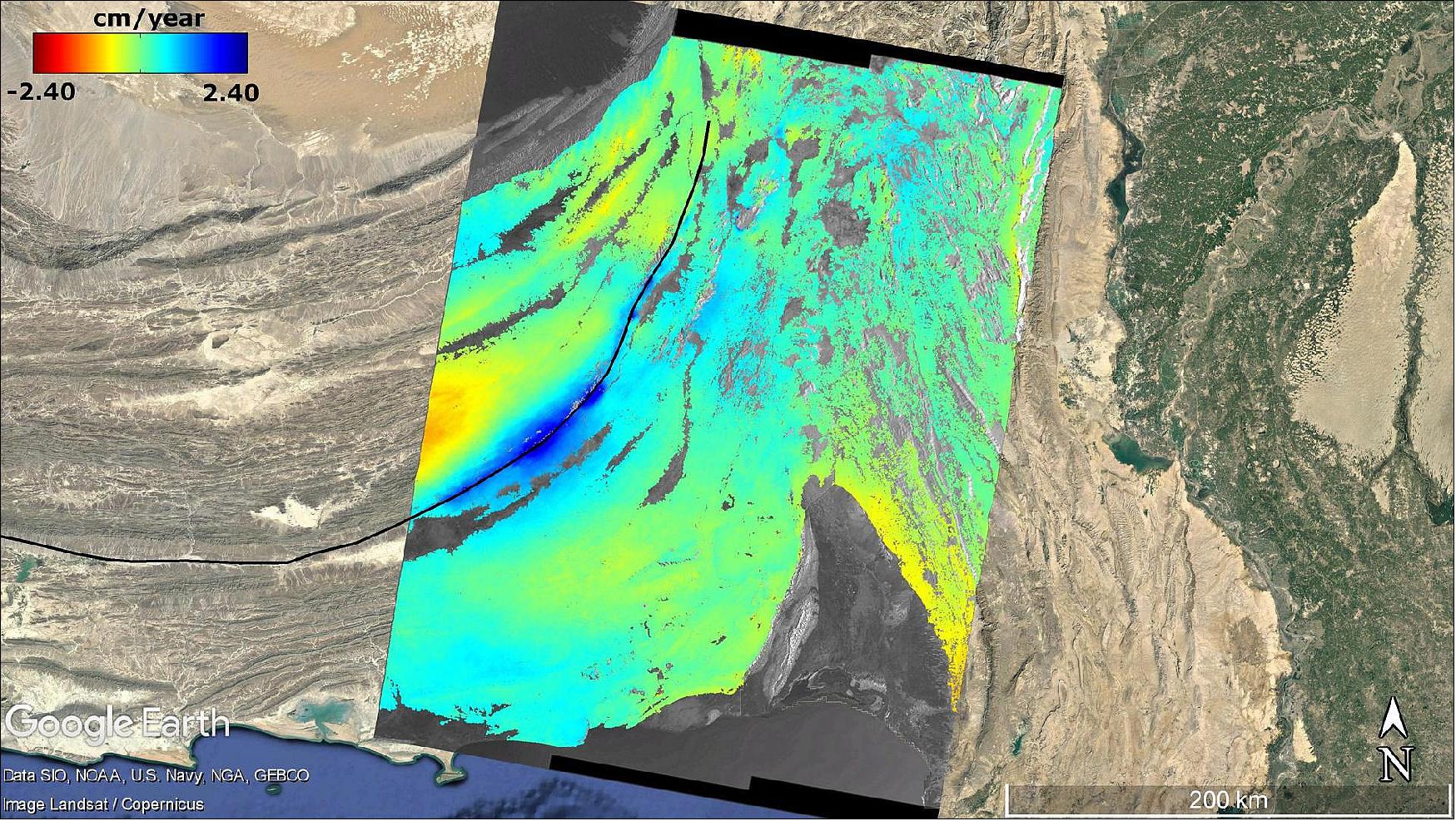
Researchers at the DLR Microwaves and Radar Institute are part of the team that submitted the initial proposal for the mission. DLR's contributions focus on the conception of the Harmony mission and the radar system, the consolidation of user and radar system requirements, and the assessment of the overall system performance. At the same time, they are endeavouring to devise a new process for synchronisation between the radar systems of the Harmony satellites and Sentinel-1. In addition, the Institute is developing a complex software tool to calculate the performance of the radar systems and create simulated radar images. In the next step, algorithms will be used to generate three-dimensional deformation maps of the Earth's surface and calculate topographical changes at volcanoes. This will prove that the user requirements for the accuracy of measurements will be met.
References
1) ”ESA moves forward with Harmony,” ESA Applications, 23 February 2021, URL: https://www.esa.int/Applications/Observing_the_Earth/ESA_moves_forward_with_Harmony
2) ”A mission for Earth's future,” DLR, 1 March 2021, URL: https://www.dlr.de/content/en/articles/news/2021/01/20210301_a-mission-for-earth-s-future.html
3) “Harmony in the Wadden,” ESA Applications, 31 March 2022, URL: https://www.esa.int/Applications/Observing_the_Earth/FutureEO/Harmony_in_the_Wadden
4) “ESA selects Harmony as tenth Earth Explorer mission”, ESA Applications, 22 September 2022, URL: https://www.esa.int/Applications/Observing_the_Earth/FutureEO/ESA_selects_Harmony_as_tenth_Earth_Explorer_mission
5) “Ministers back ESA’s bold ambitions for space with record 17% rise”, 23 November 2022, URL: https://www.esa.int/About_Us/Corporate_news/Ministers_back_ESA_s_bold_ambitions_for_space_with_record_17_rise
6) Gunter’s Space page, “Harmony A, B (Earth Explorer 10)”, URL: https://space.skyrocket.de/doc_sdat/harmony.htm
7) “Contract secures build for ESA’s Harmony mission”, 15 October 2024,
URL: https://www.esa.int/Applications/Observing_the_Earth/FutureEO/Contract_secures_build_for_ESA_s_Harmony_mission