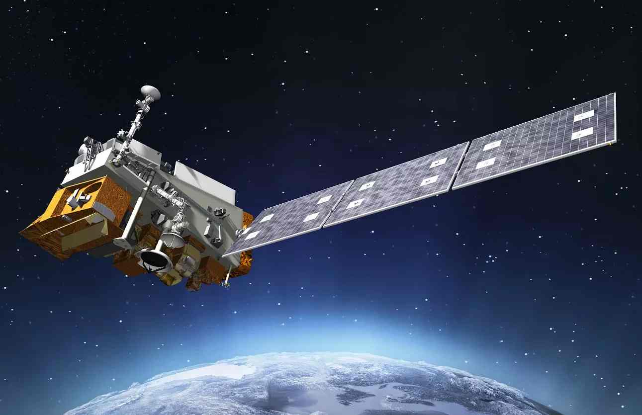
Joint Polar Satellite System (JPSS)
EO
Atmosphere
Ocean
Cloud type, amount and cloud top temperature
The Joint Polar Satellite System (JPSS) is a collaborative program between the USA’s NOAA (National Oceanic and Atmospheric Administration) and NASA (National Aeronautics and Space Administration), alongside other international partners. JPSS aims to increase the timeliness and accuracy of severe weather event forecasts, provide advanced atmospheric temperature, moisture and pressure profiles from space, and provide advanced imaging capabilities to analyse hurricanes, blizzards, fires, volcano eruptions, oil spills, and other adverse incidents. JPSS-1 (NOAA-20) and JPSS-2 (NOAA-21) were launched in November 2017 and 2022, respectively, and will be joined by JPSS-3 and -4.
Quick facts
Overview
| Mission type | EO |
| Agency | NASA, NOAA, EUMETSAT |
| Mission status | Operational (extended) |
| Launch date | 18 Nov 2017 |
| Measurement domain | Atmosphere, Ocean, Land, Snow & Ice |
| Measurement category | Cloud type, amount and cloud top temperature, Liquid water and precipitation rate, Atmospheric Temperature Fields, Cloud particle properties and profile, Ocean colour/biology, Aerosols, Multi-purpose imagery (ocean), Radiation budget, Multi-purpose imagery (land), Surface temperature (land), Vegetation, Albedo and reflectance, Surface temperature (ocean), Atmospheric Humidity Fields, Ozone, Trace gases (excluding ozone), Sea ice cover, edge and thickness, Soil moisture, Snow cover, edge and depth, Ocean surface winds, Atmospheric Winds |
| Measurement detailed | Cloud top height, Precipitation Profile (liquid or solid), Atmospheric pressure (over sea surface), Ocean imagery and water leaving spectral radiance, Aerosol absorption optical depth (column/profile), Ocean chlorophyll concentration, Downward long-wave irradiance at Earth surface, Cloud cover, Cloud optical depth, Precipitation intensity at the surface (liquid or solid), Aerosol optical depth (column/profile), Cloud type, Cloud imagery, Cloud base height, Aerosol Extinction / Backscatter (column/profile), Land surface imagery, Upward short-wave irradiance at TOA, Upward long-wave irradiance at TOA, Fire temperature, Vegetation type, Fire fractional cover, Earth surface albedo, Downwelling (Incoming) solar radiation at TOA, Leaf Area Index (LAI), Land cover, Atmospheric specific humidity (column/profile), O3 Mole Fraction, Atmospheric temperature (column/profile), Land surface temperature, Sea surface temperature, Sea-ice cover, Snow cover, Soil moisture at the surface, Wind speed over sea surface (horizontal), Normalized Differential Vegetation Index (NDVI), CO2 Mole Fraction, Sea-ice type, Soil type, Downward short-wave irradiance at Earth surface, Sea-ice surface temperature, Long-wave Earth surface emissivity, Atmospheric pressure (over land surface), Upwelling (Outgoing) long-wave radiation at Earth surface, Wind vector over land surface (horizontal), Upwelling (Outgoing) Short-wave Radiation at the Earth Surface, Upwelling (Outgoing) spectral radiance at TOA |
| Instruments | CERES, ATMS, CrIS, VIIRS, OMPS-L, OMPS-N, Libera |
| Instrument type | Imaging multi-spectral radiometers (vis/IR), Earth radiation budget radiometers, Atmospheric chemistry, Atmospheric temperature and humidity sounders |
| CEOS EO Handbook | See Joint Polar Satellite System (JPSS) summary |
Summary
Mission Capabilities
Each JPSS satellite carries a variety of instruments, including the Advanced Technology Microwave Sounder (ATMS), the Cross-track Infrared Sounder (CrIS), the Visible Infrared Imaging Radiometer Suite (VIIRS), and Clouds and the Earth’s Radiant Energy System (CERES), as well as either the Ozone Mapping and Profiler Suite (OMPS, on JPSS-1) or the Ozone Mapping and Profiler Suite Limb Profiler (OMPS-L, on JPSS-2, -3, -4). JPSS-4 will also carry Libera, designed to measure and detect trends in Earth’s energy imbalance and climate.
CrIS and ATMS work together to measure high-resolution profiles of temperature and moisture to provide data for Numerical Weather Prediction (NWP) models. VIIRS contributes to improved weather forecasting by measuring clouds and the nature of cloud content, which helps to better predict rainfall. It is also able to track long-term data on land vegetation, ocean surface features like sea surface temperature and sea ice concentration, and track fires, flooding and drought instantaneously. CERES measures the balance of sunlight, the heat in the Earth’s system and how these parameters change over time, which can be used to evaluate the effects and climatic impact of natural disasters. OMPS takes accurate long-term measurements of the Earth’s ozone layer and builds on decades of ozone observations. When combined with cloud predictions, OMPS data helps create the Ultraviolet Index, a guide to safe levels of sunlight exposure. OMPS-L replaces OMPS’s nadir-scanning spectrometer with a limb-scanning spectrometer, enabling detailed vertical profiling of Earth’s atmospheric properties.
Performance Specifications
ATMS is a 22-channel passive microwave radiometer with a nadir spatial resolution of 15.8–74.8 km and a 2600 km swath width. It operates between 23 GHz and 183 GHz. CrIS is a spectrometer with 2211 spectral channels across wavelengths of 3.92–15.38 μm, featuring a 14 km nadir spatial resolution and a 1 km vertical layer, enabling temperature profiling over a 2200 km swath.
VIIRS captures 22 spectral bands ranging from 412 nm to 12 μm with a 400 m resolution and a 3000 km swath for cloud and atmospheric observations, while CERES is a multi-channel radiometer measuring in three bands (0.3 μm to over 50 μm) at 20 km resolution. OMPS consists of a mapper and a profiler, with the mapper capturing measurements in wavelengths 0.3–0.38 μm with a 50 km resolution and 2800 km swath, while the profiler covers wavelengths of 0.25–0.31 μm with a 250 km resolution.
Libera is a broadband radiometer designed to measure solar radiation reflected by Earth and infrared radiation (wavelengths 5–50 μm) emitted from the atmosphere. It also records total outgoing radiation across wavelengths 0.3–100 μm with an added “split shortwave” channel (wavelengths 0.7–5 μm) for enhanced measurements.
All four JPSS satellites will be placed in a sun-synchronous orbit at an altitude of 833 km with an inclination of 98.75 degrees.
Space and Hardware Components
Built by Ball Aerospace and Technologies Corporation (BATC), the JPSS-1 (NOAA-20) satellite bus is based on the Ball Configurable Platform (BCP) 2000 and the Suomi-NPP design. Meanwhile, the JPSS-2 (NOAA-21) satellite bus, developed by Orbital ATK, is based on the company's LEOStar-3 platform. The JPSS payloads were developed by a consortium of manufacturers: ATMS and CERES by Northrop Grumman Electronic Systems, CrIS by Harris, VIIRS by Raytheon, OMPS by BATC, and Libera by the Laboratory of Atmospheric and Space Physics (LASP) at the University of Colorado.
Data transmission relies on a Ka-band antenna, delivering a 300 Mbit/s downlink to Common Ground System (CGS) stations in Norway, Antarctica, Alaska, and New Mexico. The Attitude Determination and Control Subsystem (ADCS) ensures precise spacecraft orientation, while propulsion is handled by eight 22 N thrusters using a mono-propellant hydrazine system.
Joint Polar Satellite System (JPSS)
Overview
The Joint Polar Satellite System (JPSS), a collaborative effort between NOAA and NASA, is a programme dedicated to maintaining and advancing capabilities in environmental monitoring through a series of polar-orbiting satellites, ensuring the long-term availability of critical weather and climate observations.
JPSS follows on from the long-running NOAA Polar Operational Environmental Satellites (POES) series, which has collected detailed data for Numerical Weather Prediction since 1978. JPSS continues this data record while aiming to improve the accuracy of severe weather predictions. The satellites collect detailed data about atmospheric temperature, moisture, and pressure, improving forecasting models for extreme weather events such as hurricanes, tornadoes, and storms. The JPSS satellites are also equipped with advanced instruments that enable monitoring and analysis of natural disasters, including wildfires, volcanic eruptions, and oil spills. 5)
Spacecraft
NASA awarded Ball Aerospace and Technologies Corporation the contract for the design and fabrication of the JPSS-1 satellite. The company developed the spacecraft bus, the Ball Commercial Platform-2000, and the Ozone Mapping and Profiler Suite (OMPS). Ball Aerospace integrated all the instruments into the bus and conducted satellite testing and launch support.
The satellite, with a lifespan of 7 years, had a launch mass of 2540 kg and a size of 4.87 x 3.61 m. Its solar array provides an end-of-life output of 1845 W. An upgrade from JPSS-1’s predecessor, the Suomi NPP satellite, was the transition from IEEE 1394 data protocol to SpaceWire to accommodate the CrIS and VIIRS instruments onboard the satellite.
Orbital ATK was contracted to design and build the JPSS-2, JPSS-3, and JPSS-4 satellites, integrate instruments into the spacecraft bus, and conduct testing. Each of the satellites has a lifespan of at least 7 years.
JPSS-2, the first weather satellite built by Orbital ATK, was manufactured at the company’s satellite manufacturing facility in Gilbert, Arizona. The satellite was based on the LEOStar-3 platform, which was also used in the Landsat-8 and Landsat-9 missions. It had a launch mass of 2930 kg and featured a deployable five-panel solar array capable of generating 4450 W.
The upcoming JPSS-4 satellite mission is designed with a launch mass of 2540 kg and will be capable of generating 1932 W of power by its end of life. 3) 6)
Launches
Mission Name | Date | Location | Orbit | Orbit Altitude | Orbit Inclination |
JPSS-1 | November 18, 2017 | Vandenberg Space Force Base, US | Sun-synchronous | 833 km | 98.75 deg |
JPSS-2 | November 10, 2022 | Vandenberg Space Force Base, US | Sun-synchronous | 833 km | 98.75 deg |
Mission Status
- July 22, 2024: NASA awarded SpaceX a $112.7 million contract to provide launch services for JPSS-4. 23)
- July 22, 2024: NASA selected SpaceX as the provider of launch services, awarding them a contract with a value of approximately $112.7 million. The JPSS-4 satellite will be launched onboard a SpaceX Falcon 9 rocket from Space Launch Complex 4 East at Vandenberg Space Force Base in California, U.S. 1)
- April 11, 2024: L3Harris completed electromagnetic interference (EMI) testing on the Cross-track Infrared Sounder (CrIS) that will be used on JPSS-4. 24)
- November 10, 2022: The JPSS-2 satellite was launched onboard an Atlas-V 401 vehicle of ULS (United Launch Services) from Vandenberg Space Force Base in California. The satellite, renamed NOAA-21 upon successfully reaching orbit, continues the work of its predecessors NOAA-20 (formerly JPSS-1) and the NOAA-NASA Suomi National Polar-orbiting Partnership (Suomi-NPP). 16)
- May 31, 2022: During recent tests of a key instrument designed to collect visible and infrared images onboard JPSS-2, the team found and corrected an issue which delayed the thermal vacuum testing phase. 17)
- October 4, 2018: The JPSS-2 mission cleared its CDR (Critical Design Review) in September 2018. The CDR is a technical review that confirms the completion of the mission ground system and flight plan before fabrication, assembly, integration and testing. 18)
- January 5, 2018: The covers on NOAA-20’s CERES FM6 (Clouds and the Earth's Radiant Energy System) opened allowing it to begin scanning the Earth. 19)
- December 13, 2017: 25 days after JPSS-1 (NOAA-20) launched it sent back its first VIIRS (Visible Infrared Imaging Radiometer Suite) science data during the instrument’s activation and testing. 20)
- November 30, 2017: 11 days after JPSS-1 was launched, the satellite sent back its first ATMS science data as part of a series of instrument startups and checkouts. 21)
- November 21, 2017: JPSS-1 reached polar orbit on Saturday, November 18, and was officially renamed NOAA-20. 22)
Sensor Complement
Instrument | Abbreviation | Purpose | Mission(s) |
Advanced Technology Microwave Sounder | ATMS | Collection of microwave radiance data | JPSS-1, JPSS-2, JPSS-4 |
Cloud and the Earth's Radiant Energy System | CERES | Atmospheric radiation measurement | JPSS-1 |
Cross-track Infrared Sounder | CrIS | Measurement of vertical atmospheric distribution of temperature, moisture, and pressure | JPSS-1, JPSS-2, JPSS-4 |
Ozone Mapping and Profiler Suite | OMPS | Measurement of total amount of ozone in the atmosphere and the ozone concentration variation with altitude | JPSS-1, JPSS-2, JPSS-4 [d] |
Ozone Mapping and Profiler Suite Limb Profiler | OMPS-L | Measurement of high resolution vertical distribution of ozone and aerosols | JPSS-2, JPSS-4 [e] |
Visible/Infrared Imager Radiometer Suite | VIIRS | Global observation of clouds, sea-surface temperature, ocean colour, land surface vegetation | JPSS-1, JPSS-2, JPSS-4 [f] |
Libera |
| Understanding the flow of energy out of the planet and its change over time | JPSS-4 [g] |
Advanced Technology Microwave Sounder (ATMS)
ATMS, present on all four of the JPSS missions’ satellites, provides the sounding observations necessary to retrieve atmospheric temperature and moisture profiles for civilian operational weather forecasting, as well as measurement continuity for climate monitoring. In addition to temperature and moisture profiles, some ATMS-derived products include integrated water vapor content, cloud liquid water content, precipitation rate, snow cover and sea ice concentration.
ATMS draws its heritage directly from AMSU-A/B (flown on the NOAA POES Series), but with reduced volume, mass and power. It has 22 microwave channels to provide temperature and moisture sounding capabilities. Sounding data from CrIS and ATMS are combined to construct atmospheric temperature profiles at 1 degree Kelvin accuracy for 1 km layers in the troposphere and moisture profiles accurate to 15% for 2 km layers. Higher spatial, temporal and spectral resolution and more accurate sounding data from CrIS and ATMS support continuing advances in data assimilation systems and Numerical Weather Prediction (NWP) models that improve short- to medium-range weather forecasts beyond three days. 11)
ATMS instrument dimensions | 70 cm x 60 cm x 40 cm |
Instrument mass | 75 kg |
Operational average power (peak) | 100 W (200 W) |
Data rate | 30 kbit/s |
Absolute calibration accuracy | 0.6 K |
Maximum nonlinearity | 0.35 K |
Frequency stability | 0.5 MHz |
Pointing knowledge | 0.03º |
NEΔT | 0.3/0.5/1.0/2.0 K |
Swath width | ~2600 km |
Channel | Center Frequency (GHz) | Max. Bandwidth (GHz) | Center Frequency Stability (MHz) | Temp. Sensitivity NEΔT (K) | Calibration Accuracy (K) |
1 | 23.8 | 0.27 | 10 | 0.9 | 2.0 |
2 | 31.4 | 0.18 | 10 | 0.9 | 2.0 |
3 | 50.3 | 0.18 | 10 | 1.20 | 1.5 |
4 | 51.76 | 0.40 | 5 | 0.75 | 1.5 |
5 | 52.8 | 0.40 | 5 | 0.75 | 1.5 |
6 | 53.596 ±0.115 | 0.17 | 5 | 0.75 | 1.5 |
7 | 54.40 | 0.40 | 5 | 0.75 | 1.5 |
8 | 54.94 | 0.40 | 10 | 0.75 | 1.5 |
9 | 55.50 | 0.33 | 10 | 0.75 | 1.5 |
10 | 57.290344 | 0.33 | 0.5 | 0.75 | 1.5 |
11 | 57.290344 ±0.217 | 0.078 | 0.5 | 1.20 | 1.5 |
12 | 57.290344 ±0.3222 ±0.048 | 0.036 | 1.2 | 1.20 | 1.5 |
13 | 57.290344 ±0.3222 ±0.022 | 0.016 | 1.6 | 1.50 | 1.5 |
14 | 57.290344 ±0.3222 ±0.010 | 0.008 | 0.5 | 2.40 | 1.5 |
15 | 57.290344 ±0.3222 ±0.0045 | 0.003 | 0.5 | 3.60 | 1.5 |
16 | 87-91 | 2.0 | 200 | 0.5 | 2.0 |
17 | 166.31 | 2.0 | 200 | 0.6 | 2.0 |
18 | 183.31±7.0 | 2.0 | 100 | 0.8 | 2.0 |
19 | 183.31±4.5 | 2.0 | 100 | 0.8 | 2.0 |
20 | 183.31±3.0 | 1.0 | 50 | 0.8 | 2.0 |
21 | 183.31±1.8 | 1.0 | 50 | 0.8 | 2.0 |
22 | 183.31±1.0 | 0.5 | 30 | 0.9 | 2.0 |
Cloud and the Earth's Radiant Energy System (CERES)
CERES will provide measurements of the space and time distribution of the Earth's Radiation Budget (ERB) components, further developing a quantitative understanding of the links between the ERB and the properties of the atmosphere and surface that define the budget.
The ERB measurements provided by the CERES instrument are key elements in the production of ERB Climate Data Records, which have been produced continuously for more than 20 years, including measurements from the ERBE (Earth Radiation Budget Experiment) before CERES. Maintaining the continuity of these measurements and the ERB records are part of an overarching NOAA program objective to sustain continuity and enhance Earth observation analysis, forecasting, and climate monitoring capabilities from global polar-orbiting observations. 14)
Cross-track Infrared Sounder (CrIS)
CrIS is a high-spectral and high-spatial resolution infrared sounder for atmospheric profiling applications. The overall objective is to perform daily measurements of Earth's upwelling infrared radiation to determine the vertical atmospheric distribution (surface to the top of the atmosphere) of temperature (profiles to better than 1 K accuracy in the lower troposphere and lesser accuracy at higher altitudes), moisture (profiles to better than 20-35% accuracy depending on altitude) and pressure (profiles to better than 1.0% accuracy ) with an associated 1.0 km vertical layer resolution. 12)
Spectral channels | 1305 |
Spectral range | 3.9 to 15.4 µm |
Spectral resolution | 1 km |
Ground spectral resolution | 14 km |
Data rate | <1.5 Mbit/s |
IFOV arrangement | 3 x 3 array |
Swath width | 2200 km |
Ozone Mapping and Profiler Suite (OMPS)
OMPS is an instrument developed by NOAA to measure atmospheric ozone levels. It is a high-resolution nadir-scanning shortwave (SW) spectrometer that uses cross-track scanning technology to measure the total amount of ozone in the atmosphere. OMPS consists of two nadir sensors: the Nadir Mapper, which captures total column ozone measurements with a 50 km resolution and a 2,800 km swath width, and the Nadir Profiler, which provides ozone profile measurements with a 250 km resolution and a 250 km swath width. The instrument works in the ultraviolet (UV) spectrum, with the Nadir Mapper covering values between 0.3 and 0.38 µm and the Nadir Profiler covering between 0.25 and 0.31 µm. 7)
Ozone Mapping and Profiler Suite Limb Profiler (OMPS-L)
The Ozone Mapping and Profiler Suite Limb Profiler (OMPS-L) is an operational instrument developed by NASA in collaboration with NOAA to measure the high-resolution vertical distribution of ozone and aerosols in Earth's atmosphere. Using limb-scanning technology, OMPS-L provides detailed atmospheric profiles by capturing measurements at multiple altitudes along the instrument's line of sight. It is a shortwave (SW) spectrometer that operates across a broad waveband range from 280 to 1020 nm. The instrument has a vertical resolution of 1 km, with a maximum swath width of 250 km. OMPS-L captures accurate ozone and aerosol data measurements, with a relative accuracy of 10% or 20 parts per billion (ppb) for ozone from the tropopause to 60 km and 20% accuracy for aerosol extinction from the tropopause to 35 km. 8)
Visible/Infrared Imager Radiometer Suite (VIIRS)
VIIRS is a multispectral (22-band) opto-mechanical radiometer, employing a cross-track rotating telescope fore-optics design (operating on the whiskbroom scanner principle) to cover a wide swath. The rotating telescope assembly (RTA of 20 cm diameter) concept of SeaWiFS heritage allows a low straylight performance. An observation scene is imaged onto three focal planes, separating the VNIR, SWIR/MWIR, and TIR energy - covering a spectral range of 0.4 - 12.5 µm. The VNIR FPA (Focal Plane Array) has nine spectral bands, the SWIR/MWIR FPA has eight spectral bands, and the TIR FPA has four spectral bands. The integral DNB (Day Night Band) capability provides a very large dynamic range low-light capability in all VIIRS orbits.
The detector line arrays (16 detectors in each array for the SWIR/MWIR and TIR bands and 32 detectors in the array for the VNIR and DNB (Pan) bands) of the whiskbroom scanner are oriented in the along-track direction. This arrangement provides a parallel coverage of 11.87 km along-track in one scan sweep (cross-track direction). The wide along-track coverage permits sufficient integration time for all cells in each scan sweep. One cross-track scan period of RTA is 1.786 s in length, and the data quantization is 12 bits (14 bit A/C converters for lower noise). Typical data products (types) of VIIRS include atmospheric, clouds, earth radiation budget, clear-air land/water surfaces, sea surface temperature, ocean color, and low-light visible imagery. A swath width of 3000 km is provided (corresponding to a field of view of approximately 55.84º) with a spatial resolution for imagery related products of no worse than 0.4 km to 0.8 km (nadir to edge-of-scan). The radiometric bands provide a resolution about twice in size to the imagery bands. 10)
Detector line arrays | 16 detectors per array (SWIR/MWIR & TIR) 32 detectors per array (VNIR & DNB) |
Scanner type | Whiskbroom |
Detector orientation | Along-track |
Along-track coverage | 11.87 km |
Cross-track scan period | 1.786 s |
Swath width | 3000 km |
Field of view (FOV) | ~55.84º |
Spatial resolution | 0.4 km (nadir) to 0.8 km (edge-of-scan) |
Libera
Libera will fly onboard the JPSS-4 satellite. The instrument’s broad-band radiometer is designed to capture accurate readings of solar radiation with wavelengths between 0.3 and 0.5 µm reflected by the Earth, as well as infrared radiation with wavelengths between 5 and 50 µm emitted from the Earth as it exits the top of the atmosphere. The instrument will also measure the total outgoing radiation from the Earth system at all wavelengths from 0.3 to 100 µm. An additional “split shortwave” channel, which was designed to measure radiation between 0.7 and 5 µm, has been added to the instrument. 2) 13)
Ground Segment
The Raytheon Company was awarded a contract by NASA on behalf of NOAA for the development of the JPSS Common Ground System, which enables uninterrupted support to meet both civilian and defense weather needs. It allows Raytheon to continue the development and evolution of the ground system into an exceptional operational program for JPSS and DMSP (Defense Meteorological Satellite Program). The main elements of the JPSS common ground system for NOAA and the US Department of Defense are Command, Control and Communications Segment, Mission Management Center, Interface Data Processing Segment, and the Field Terminal Segment. 14)
The Command, Control, and Communications Segment (C3S) includes mission planning, enterprise management, antenna resource scheduling, satellite operations, data relay and spacecraft and instrument engineering. A key feature of the C3S is the 15 unmanned global ground stations that receive JPSS mission data, termed the DRN (Distributed Receptor Network). The receptors, linked with high-bandwidth commercial fiber, can quickly transport the data to four U.S. data processing centers. Most data will ultimately be completely processed and delivered to the Weather Centrals in less than 30 minutes from the time of collection. 15)
The Mission Management Center (MMC) provides accurate, high-performance tools that precisely manage JPSS missions. The C3S tools give crews keen insight, comprehensive operational oversight, detailed mission planning capability, full control of space and ground assets, continuous monitoring and assessment of overall system performance.
The Interface Data Processing Segment (IDPS) features high-speed, symmetric, multi-processing computers that rapidly convert large streams of JPSS sensor data that are 100 times the volume of legacy data, providing numerous EDRs (Environmental Data Records) at four weather Centrals in the United States. These vital EDRs range from atmospheric to land and ocean surface products. The EDRs detail cloud coverage, temperature, humidity and ozone distribution, as well as snow cover, vegetation, sea surface temperatures, aerosols, space environment and earth radiation budget information. This wealth of information enables numerous users to monitor and predict changes in weather, climate, and ocean conditions. JPSS products are also available to the scientific community to expand our knowledge of the environment.
The Field Terminal Segment (FTS), equipped with specially configured IDPS software, permits worldwide fixed and mobile field terminals deployed aboard ships, at military bases, in theaters of operation, and at educational and scientific institutions to receive and process the continuous broadcasts of JPSS sensed data as the satellites pass overhead.
References
1) NASA, “NASA Awards Launch Services Contract for NOAA’s JPSS-4 Mission”, URL: https://www.nasa.gov/news-release/nasa-awards-launch-services-contract-for-noaas-jpss-4-mission/
2) NASA, “Libera”, URL: https://science.jpl.nasa.gov/projects/libera/
3) OSCAR, “Satellite: JPSS-4”, URL: https://space.oscar.wmo.int/satellites/view/jpss_4
4) NOAA, “OMPS”, URL: https://www.nesdis.noaa.gov/our-satellites/currently-flying/joint-polar-satellite-system/ozone-mapping-and-profiler-suite-omps
5) NOAA, “JPSS”, URL: https://www.nesdis.noaa.gov/about/our-offices/office-of-low-earth-orbit-observations
6) “JPSS-4”, The CEOS Database, URL: https://database.eohandbook.com/database/missionsummary.aspx?missionID=802
7) “OMPS”, The CEOS Database, URL: https://database.eohandbook.com/database/instrumentsummary.aspx?instrumentID=681
8) “OMPS-L”, The CEOS Database, URL: https://database.eohandbook.com/database/instrumentsummary.aspx?instrumentID=1718
9) “VIIRS”, The CEOS Database, URL: https://database.eohandbook.com/database/instrumentsummary.aspx?instrumentID=412
10) “ATMS”, The CEOS Database, URL: https://database.eohandbook.com/database/instrumentsummary.aspx?instrumentID=413
11) “CrIS”, The CEOS Database, URL: https://database.eohandbook.com/database/instrumentsummary.aspx?instrumentID=325
12) “Libera”, The CEOS Database, URL: https://database.eohandbook.com/database/instrumentsummary.aspx?instrumentID=1904
13) “CERES”, The CEOS Database, URL: https://database.eohandbook.com/database/instrumentsummary.aspx?instrumentID=397
14) GlobalSecurity, “Raytheon Awarded Joint Polar Satellite System Contracts”, URL: https://www.globalsecurity.org/space/library/news/2010/space-100930-raytheon01.htm
15) SpaceDaily, “Raytheon receives contract modification on JPSS Common Ground System”, URL: https://www.spacedaily.com/reports/Raytheon_receives_contract_modification_on_JPSS_Common_Ground_System_999.html
16) "Mighty Atlas V Launches JPSS-2 Weather-Watcher, NASA Re-Entry Demonstrator," America Space, URL: https://www.americaspace.com/2022/11/10/mighty-atlas-v-launches-jpss-2-weather-watcher-nasa-re-entry-demonstrator/
17) "NASA Eyes November for Launch of NOAA’s JPSS-2," NASA, URL: https://www.nasa.gov/missions/nasa-eyes-november-for-launch-of-noaas-jpss-2/
18) "JPSS Science Seminar Annual Digest 2018," NOAA, URL: https://www.nesdis.noaa.gov/s3/2021-12/2018_science_seminar_digest.pdf
19) "First Light’ Images from CERES FM6 Earth-observing Instrument," NASA, URL: https://ceres.larc.nasa.gov/news/first-light-images-from-ceres-fm6-earth-observing-instrument/
20) "First Science Data from NOAA-20," CEOS, URL: https://ceos.org/home-2/noaa-20/
21) "First Light Image from NOAA-20's ATMS Sensor," NOAA, URL: https://www.nesdis.noaa.gov/news/first-light-image-noaa-20s-atms-sensor
22) "The Joint Polar Satellite System (JPSS)," NOAA, URL: https://www.noaasis.noaa.gov/POLAR/JPSS/jpss.html
23) "NASA Awards Launch Services Contract for NOAA’s JPSS-4 Mission," NOAA, URL: https://www.nesdis.noaa.gov/news/nasa-awards-launch-services-contract-noaas-jpss-4-mission