OCO-2 (Orbiting Carbon Observatory-2)
EO
Atmosphere
NASA
Operational (extended)
Launched in July 2014, OCO-2 (Orbiting Carbon Observatory-2) is an Earth observing satellite mission owned and operated by NASA (National Aeronautics and Space Administration), and the successor to OCO-1, which was lost due to a launch vehicle failure in February 2009. OCO-2 is dedicated to the study of atmospheric carbon dioxide and oxygen, including global geographical distribution of carbon dioxide and oxygen sources and sinks.
Quick facts
Overview
| Mission type | EO |
| Agency | NASA |
| Mission status | Operational (extended) |
| Launch date | 02 Jul 2014 |
| Measurement domain | Atmosphere |
| Measurement category | Trace gases (excluding ozone) |
| Measurement detailed | CO2 Mole Fraction |
| Instruments | Spectrometer (OCO-2) |
| Instrument type | Atmospheric chemistry |
| CEOS EO Handbook | See OCO-2 (Orbiting Carbon Observatory-2) summary |
Summary
Mission Capabilities
OCO-2 carries a single instrument, which shares the same name as the mission itself. The instrument comprises of three NIR/SWIR (Near Infrared/ Short Wave Infrared) spectrometers, with two optimised for observations of atmospheric carbon dioxide, and another optimised for observations of atmospheric oxygen, with data applicable in studies of atmospheric composition, as well as carbon dioxide and oxygen distribution. The instrument images in three modes, Nadir mode, viewing directly below the spacecraft, glint mode, viewing the location where sunlight is directly reflected on the Earth's surface, and Target mode, viewing a specified surface target continuously.
Performance Specifications
The OCO-2 instrument utilises a pushbroom scanning technique with a cross-track swath width of 10 km and spatial resolution of 1.29 km cross-track and 2.25 km along-track. For observation and measurement of atmospheric oxygen, OCO-2 utilises a spectral range of 758-772 nm, with spectral resolution 0.04 nm. For the observation of atmospheric carbon dioxide, the instrument utilises two bands, one with a spectral range of 1594-1619 nm and spectral resolution 0.08 nm, while the other has a spectral range of 2042-2082 nm with spectral resolution 0.10 nm. All three of the bands have 1024 channels.
OCO-2 operates in a sun-synchronous orbit of altitude 705 km with an inclination of 98.2°, orbital period of 98.8 minutes and ECT (Equatorial Crossing Time) of 1330 hours on ascending node, as well as a 16 day repeat cycle.
Hardware Components
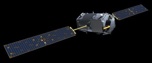
OCO-2 uses a three axis stabilised LeoStar-2 bus, consisting of a 2.12 m long hexagonal column 0.94 m wide, with a launch mass of 449 kg. The bus contains the ACS (Attitude Control Subsystem) module, consisting of four reaction wheels, star trackers, a MIMU (Miniature Inertial Measurement Unit), 13 sun sensors and a magnetometer. The bus also carries a 96 Gbit solid state recorder for onboard data storage, with both science and housekeeping data downlinked using an L3 Communications X-band transmitter and a body-mounted X-band patch antenna, at a data rate of 150 Mbit/s
OCO-2 (Orbiting Carbon Observatory-2)
Spacecraft Launch Mission Status Sensor Complement Ground Segment ReferencesSince the 1970s NASA has played a continuous and critical role in studying the global carbon cycle and Earth's climate. Over the years, NASA has paved the way for global Earth observation through the use of satellite remote sensing technology, building a fleet of Earth-observing satellites that have helped the agency and the world meet specific scientific objectives for studying Earth's land, oceans, and atmosphere, and interactions between them.
Currently (mid-2014), there are 17 operating NASA Earth science satellite missions, including OCO-2. Each satellite has provided new perspectives and data that have helped us better understand our home planet as a complex system. The Landsat series (1972-present), the oldest U.S. land surface observation system, allowed the world to see seasonal and interannual land surface changes. The ocean's role in the global carbon cycle and ocean primary productivity (rate of carbon fixation from the atmosphere) was studied using data from the SeaWiFS (Sea-viewing Wide Field-of-view Sensor) from 1997 to 2010, which also helped to estimate the rate of oceanic carbon uptake. Ocean colour and photosynthetic activity are measured by the MODIS (Moderate Resolution Imaging Spectroradiometer) instruments onboard the Terra and Aqua satellites (launched in 1999 and 2002, respectively), and more recently by the VIIRS (Visible Infrared Imaging Radiometer Suite) on the Suomi-NPP ( National Polar-orbiting Partnership) satellite, launched in 2011. NASA studies the atmosphere and weather with the AIRS (Atmospheric Infrared Sounder) on Aqua, which is tracking the most abundant greenhouse gas—water vapor—as well as mid-tropospheric CO2.
The launch of OCO-2 (July 2, 2014) continues these essential measurements, needed to further our scientific understanding of such phenomena. Data from OCO-2 will provide significant clues in the quest to find those elusive "missing pieces" of the carbon puzzle and where they fit in the larger picture. Piece by piece, scientists will continue reaching their goal of better understanding Earth's complex carbon cycle and the impact humans are having on Earth's environment.
Spacecraft
OCO-2 is based on the Orbiting Carbon Observatory (OCO) to the extent possible. OCO-2 will be a dedicated spacecraft to fly a single instrument comprised of three high resolution grating spectrometers. 8) 9)
The spacecraft is three-axis zero-momentum stabilised, using the LeoStar-2 bus of OSC [LeoStar-2 is of OCO, SORCE (Solar Radiation and Climate Experiment) and GALEX (Galaxy Evolution Explorer) heritage]. The bus houses and points the instrument, provides power, receives and processes commands from the ground, records, and downlinks the data collected by the instrument, and maintains its position with the EOS A-Train. The primary structure consists of a 2.12 m long hexagonal column that is 0.94 m wide.
ACS (Attitude Control Subsystem): The ACS points the instrument for science and calibration observations and the body-mounted X-band antenna at the ground station for data downlink. Pitch, roll, and yaw are controlled by 4 reaction wheels. Three magnetic torque rods are used to de-spin the reaction wheels. OCO-2 uses the same types of Goodrich/Ithaco reaction wheels and torque rods that were used for OCO. However, the reaction wheels have been modified to address lifetime issues identified over the past decade.
The system autonomously acquires attitude data in under three seconds and tracks up to ten stars simultaneously providing an attitude frame ten times/s. SED26 can operate with planets and the Moon in the field of view and uses a baffle to eliminate sunlight with sun exclusion angles of 25 or 30º. The star tackers can continue tracking acquired stars up to a spacecraft motion of 10°/s. Each star tracker unit weighs 3.5 kg and is 16 by 17 by 30 cm in size.
Three-axis angular measurement is provided by a MIMU (Miniature Inertial Measurement Unit) manufactured by Honeywell. The IMU (Inertial Measurement Unit) has extensive flight heritage and features a robust design using the GG1320 ring laser gyro that provides precise rotation measurements.
The spacecraft orbit is determined by a GPS receiver of General Dynamics Viceroy. Pointing information is provided by a star tracker (Sodern), a MIMU (Miniature Inertial Measurement Unit) of Honeywell, and a magnetometer of Goodrich.
EPS (Electrical Propulsion Subsystem): Two deployable solar panels supply ~900 W when illuminated at near normal incidence (use of GaAs solar cells). The solar panels charge an Eagle Picher 35 Ah NiH (Nickel-Hydrogen) battery that provides power during eclipse. OCO-2 uses the same battery model used by OCO.
OBC (On-Board Computer): The central electronics unit uses a RAD-6000 single-board flight computer of BAE to manage the attitude control, power, propulsion, and telecom systems, and the 128 Gbit solid-state recorder of Seaker that stores the science data collected by the instrument. The RAD6000 had to be modified to replace the SRAM (Static Random Access Memory) part, which was based on an obsolete, 16-chip MCM (Multi-Chip Module) with a newer SRAM part. - The CPU consists of 1.1 million transistors. It has an L1 cache memory of 8 kB and controls up to 128 MB of SRAM memory. The spacecraft control unit also includes 1 GB of Random Access Memory and 3 MB of non-volatile memory storing the flight software and command sequences without a loss of data in case of a power outage.
RF communications: Both science and housekeeping data are usually returned to the ground at 150 Mbit/s using an L3 Communications X-band transmitter and a body-mounted X-band patch antenna. Spacecraft and instrument housekeeping data can also be returned by an S-band transmitter (2 Mbit/s) to a ground station or through a NASA TDRS (Tracking and Data Relay Satellite) system. The uplink is implemented with an S-band receiver and a pair of omni-directional antennas. OCO-2 will use S-band hardware from TAS (Thales Alenia Space) that meets the same performance requirements as OCO, but is based on a new, all-digital design. Science data is stored in a 96 Gbit solid state recorder that interfaces with the communications system to be able to downlink the acquired science data.
Spacecraft bus | LeoStar-2 bus of OSC (LeoStar-2 is of OCO-1, SORCE and GALEX mission heritage) |
Spacecraft launch mass | 449 kg |
Solar arrays | Triple junction GaAs, NiH battery with a capacity of 35 Ah |
Spacecraft power | 521 W orbit average, single axis articulated arrays |
Spacecraft stabilisation | 3-axis, zero momentum, nadir and target pointing |
Propulsion | Hydrazine |
Mission design life | 2 years |
Orbit | Altitude of 705 km, flying in polar, sun-synchronous formation with the EOS A-train |
RF communications | S-band transceiver and X-band science data transmitter |
Development Status
• The OCO-2 mission underwent CDR (Critical Design Review) in August 2010 and key design point-C (KDP-C) in September 2010 (Ref. 1).
• The OCO-2 instrument will be delivered in the spring of 2012 (Ref. 63).
• On April 30, 2014, NASA's OCO-2 arrived at the VAFB launch site after traveling from Orbital Sciences Corp.'s Satellite Manufacturing Facility in Gilbert, AZ. The spacecraft now will undergo final tests and then be integrated on top of a ULA (United Launch Alliance) Delta-2 rocket in preparation for a planned July 1 launch. 11)
Launch
The OCO-2 spacecraft was launched on July 2, 2014 (09:56:23 UTC) on a Delta-2 7320-10C vehicle from VAFB, CA. 12) 13) NASA contracted ULA (United Launch Services LLC) in July 2012. 14) 15) 16)
Note: Originally, NASA planned a launch of the OCO-2 mission for Feb. 2013 on a Taurus- XL 3110 vehicle of OSC (However, the configuration Taurus-XL and the OCO-1 spacecraft experienced already a launch failure on Feb. 24, 2009. This was followed by a launch failure of NASA's Glory spacecraft on a Taurus-XL 3110 vehicle on March 4, 2011). — Hence, in early 2012, NASA and OSC mutually agreed to terminate the existing launch contract for OCO-2. In early February 2012, NASA released a multi-mission request for launch service proposals that included the OCO-2 mission. Once NASA officials select a new rocket for OCO-2, it will involve a launch delay at least into the year 2014. 17) 18)
Orbit
Sun-synchronous orbit, altitude = 705 km, inclination = 98.2º, period = 98.8 min, repeat cycle of 16 days, equatorial crossing time at 13:30 hours on an ascending node.
OCO-2 will initially be launched into an orbit of 690 km altitude. The on-board propulsion system will then raise the orbit to 705 km. The OCO-2 spacecraft will become part of the "A-Train" (a loose formation of the Afternoon Constellation consisting of: Aqua, CloudSat, CALIPSO, Glory, PARASOL, Aura, and OCO-2) to correlate the OCO-2 data with data acquired by other instruments such as AIRS on Aqua. OCO-2 will fly ahead of the A-train, about 15 minutes before the Aqua spacecraft.
The A-Train formation flying coordination, data exchange management, and coordination of cooperative science campaigns is performed by the Afternoon Constellation Mission Operations Working Group (MOWG) composed of agencies contributing satellites to the A-Train. In early August 2014, the OCO-2 (Orbiting Carbon Observatory-2) is expected to join the A-Train.
OCO-2 science operations will begin about 45 days after launch. Scientists expect to begin archiving calibrated mission data in about six months and plan to release their first initial estimates of atmospheric carbon dioxide concentrations in early 2015 (Ref. 12).
Mission Status
• March 31, 2022: For the first time, researchers detected short-term, regional fluctuations in atmospheric carbon dioxide (CO2) from human activities using a combination of NASA satellites and atmospheric modeling19) 20) . The study used data from NASA's Orbiting Carbon Observatory-2 (OCO-2) to measure reductions in CO2 emissions during the COVID-19 pandemic. With daily and monthly data now available, scientists can track human impacts on CO2 concentrations in near real-time. Previous studies noted a slight drop in global CO2 levels in 2020 due to pandemic lockdowns. By integrating OCO-2’s high-resolution data with NASA’s Goddard Earth Observing System (GEOS) models, researchers distinguished changes caused by human activity from those due to natural processes at regional scales, confirming prior estimates based on economic data. They found that human-caused CO2 growth in the Northern Hemisphere slowed between February and May 2020 before rebounding in the summer, aligning with a global emissions decrease of 3% to 13% for the year. This approach marked a breakthrough in studying regional climate effects and tracking mitigation strategies, allowing the detection of atmospheric CO2 changes just a month or two after they occur.
- CO2 levels have risen nearly 49% since the Industrial Revolution, passing 400 parts per million in 2013. While CO2 can linger in the atmosphere for up to a century, short-term changes, like those from the 2020 lockdowns, can be hard to detect. NASA's OCO-2 satellite, with high-precision spectrometers, tracked these fluctuations. By comparing CO2 measurements with emissions estimates, the team confirmed that the reductions were largely due to human activities during the pandemic.
- The team found that CO2 growth in the Northern Hemisphere dropped by 3% to 13% from February to May 2020, aligning with emissions reductions due to lockdowns. In the Southern Hemisphere, the signal was obscured by the intense positive phase of the Indian Ocean Dipole (IOD), which impacted the carbon cycle through events like the Australian fire season. This highlighted GEOS/OCO-2's potential for tracking natural CO2 fluctuations. GEOS/OCO-2 data power one of the indicators in the COVID-19 Earth Observing Dashboard, a partnership between NASA, the European Space Agency, and the Japan Aerospace Exploration Agency.
• November 16, 2021: NASA's real-time 3D visualisation tool Eyes on the Earth recieved an upgrade to include more datasets, putting the world at your fingertips. Using the tool, it's possible to track the planet's vital signs – e.g. carbon dioxide, carbon monoxide, sea level and soil moisture levels – as well as follow the fleet of Earth satellites providing those measurements, including OCO-2. 21)
• July 10, 2020: The U.S. Midwest emits a faint glow during the growing season due to healthy plants performing photosynthesis, a process that absorbs sunlight to convert carbon dioxide and water into food. The glow—emitted by healthy, productive plants all over the world—is far too dim to be seen with the naked eye. In recent years, however, scientists have worked on detecting this signal using satellites. And they're using it to make some remarkable observations. 22) This glow, known as Solar Induced Fluorescence (SIF), occurs when chlorophyll "leaks" photons during photosynthesis. Though invisible to the naked eye, scientists can detect this signal using satellites. SIF provides a direct link to plant productivity, with higher fluorescence indicating that plants are absorbing more carbon dioxide from the atmosphere to fuel their growth.
- Because fluorescence offers a direct view into the photosynthetic machinery of plants, scientists can use it to detect nuances in the growing season that might be missed by other methods that rely on changes in vegetation colour, or "greenness." Detecting the faint signal of fluorescence with satellites has been a challenge, but scientists have made fast progress. In 2014,, scientists showed that the U.S. Midwest is one of the most productive growing regions in the world, out-glowing even the Amazon rainforest at times. Then in 2016, they discovered that the growing season of forests in northern latitudes is often weeks longer than previously thought. Most of that pioneering work with SIF was done with satellites and instrument—such as JAXA's GOSAT, ESA's GOME-2 and SCIAMACHY, and NASA's OCO-2—not specifically designed to measure SIF.
- In a 2020 study, Caltech scientists used high-resolution fluorescence data from the TROPOMI instrument on ESA's Sentinel-5P satellite to monitor cropland changes in near-real-time. They found that Midwest cropland productivity dropped by 15% in 2019 due to record-wet conditions that altered the growing season. This decline in crop productivity also impacted the carbon cycle, as plants absorb carbon dioxide during photosynthesis. The researchers estimated a reduction of 100 million metric tons in carbon uptake by Midwest crops during June and July 2019. NASA’s OCO-2 satellite and aircraft data confirmed higher atmospheric CO2 levels over the region due to this reduced carbon capture.
• March 6, 2020: A new NASA/university study using satellite data provided the first direct evidence that as a city's population density increases, its per capita carbon dioxide emissions generally decrease, though there are exceptions. The study, based on data from NASA's Orbiting Carbon Observatory-2, highlights how satellite measurements can help fast-growing cities track their CO2 emissions and evaluate the effects of policy changes and infrastructure improvements on energy efficiency. 23) Using data from NASA's Orbiting Carbon Observatory-2, researchers found links between the population density of cities and how much carbon dioxide they produce per person.
- Cities produce over 70% of global CO2 emissions from energy, and urbanisation is increasing. Some densely populated cities, however, emit more CO2 per capita than others. To understand why, scientists from the University of Utah, NASA's Goddard Space Flight Center, and the University of Michigan used NASA's OCO-2 satellite data to calculate CO2 emissions for 20 cities worldwide. They selected cities with minimal vegetation to simplify the measurements. Traditionally, emissions were estimated using a "bottom-up" approach, but this study used a "top-down" method, relying on satellite data to track CO2 levels above urban areas. Published February 20 in the journal Environmental Research Letters, the study found that cities with higher population densities generally have lower per capita carbon dioxide emissions, in line with previous bottom-up studies based on emissions inventories. But the satellite data provided new insights. 24)
- Scientists hypothesised that densely-populated urban areas emit less CO2 per person due to energy efficiency factors. OCO-2 data, however, showed exceptions. Cities with power generation facilities, like Yinchuan and Johannesburg, had higher emissions than expected for their population density. Wealthier cities, like Phoenix, also produced more emissions per capita compared to less affluent cities like Hyderabad. While OCO-2 could observe emissions from cities, OCO-3, with its agile mirror-pointing system, can create detailed CO2 maps over small areas, such as power plants or large urban regions, much faster.
• February 2019: The OCO-2 (Orbiting Carbon Observatory-2) had been in orbit since 2014, and its global coverage held the potential to reveal new information about the carbon cycle through the use of top-down atmospheric inversion methods combined with column average CO2 retrievals. 25) Understanding the carbon cycle was crucial for predicting Earth's future climate, as it was modeled through processes like photosynthesis, respiration, nutrient cycling, fire, and fossil fuel inventories. CO2 measurements constrained the net flux exchanged between the atmosphere and Earth's surface 26).
- OCO-2 measures radiances in spectral bands near 0.765 µm, 1.61 µm, and 2.06 µm, capturing 8 soundings across a 10 km swath, with a spatial footprint of less than 1.29 km by 2.25 km 27) . This resolution increased cloud-free retrievals and reduced errors, while also revealing systematic biases in XCO2 over small areas. It orbits in the EOS Afternoon Constellation (A-Train) with a sun-synchronous orbit at 705 km, crossing the equator between 1:21 pm and 1:30 pm local time. OCO-2 and GOSAT were extensively validated against the Total Carbon Column Observing Network (TCCON), identifying systematic errors that required empirical corrections.
- The study was part of a large model intercomparison project (MIP) organised by the OCO-2 Science Team. It aimed to understand how flux estimates using OCO-2 retrievals and in situ measurements were affected by factors like transport models, data assimilation methods, prior flux estimates, and systematic retrieval errors. The MIP involved modelers using various transport models, data assimilation frameworks, and prior flux configurations. The study used the Version 7 retrospective (V7r) OCO-2 retrieval dataset, released in 2015, with the precision required for scientific use. Early analyses identified a residual bias related to high albedo regions in the 2 µm band and low albedos in the O2 A-band. A correction was applied to reduce the "s31" bias linked to the signal-to-noise ratio in the O2 and CO2 bands. Individual OCO-2 retrievals provided fine-scale details, but global models used larger grid boxes (100 km or more), limiting full resolution. (Ref. 25) has more details about the studies)
• May 2018: Early flux inversion studies indicated that space based remote sensing observations of XCO2 with accuracies of 0.25% (1 ppm) on regional scales at monthly intervals could substantially improve our understanding of CO2 sources and sinks. 28) Recent products from the OCO-2 mission met or exceeded expected performance targets 29). However, despite this progress, further improvements in measurement accuracy, precision, resolution, and coverage were still necessary. These enhancements were crucial for providing timely and reliable data on anthropogenic emissions at the scale of individual nations and for tracking subtle trends in the natural carbon cycle affected by climate change. To accurately analyse CO2 flux at local and regional scales, spatial and temporal biases in XCO2 measurements had to be reduced to extremely small values (much less than 1 ppm). Additionally, greater precision was needed to monitor emissions from localised sources like cities and power plants, and higher spatial and temporal resolution was required to detect and track variations in carbon sources and sinks over time.
- Improved global coverage was especially needed at high northern latitudes during winter and in tropical regions often obscured by thick clouds. Achieving these goals required advances in space-based instruments, calibration methods, retrieval algorithms, and validation strategies, as well as more effective coordination between space-based, airborne, and ground-based sensors to create a comprehensive greenhouse gas monitoring system.
• May 31, 2018: Carbon, a fundamental element for life on Earth, moves continuously between the atmosphere, ocean, and land, taking various forms from both natural and human-induced sources. Tracking and quantifying carbon's movement through these systems is a complex task due to the numerous processes involved. NASA plays a key role in addressing this challenge by using space-based and airborne sensors to observe and measure carbon across the globe. For over two decades, NASA develops technologies and methodologies for monitoring carbon, investing significantly in spacecraft, instruments, datasets, research, and computer modeling. This effort includes collaboration with U.S. and international partners.
- Several NASA missions, including those managed by NASA’s Jet Propulsion Laboratory (JPL), collect global data on different carbon forms, contributing to the field of carbon cycle science. This research focuses on greenhouse gases such as carbon dioxide and methane. NASA’s OCO-2 (Orbiting Carbon Observatory-2), launched in 2014, provides high-precision global measurements of atmospheric carbon dioxide and offers insights into the natural processes that regulate carbon exchange between land, ocean, and air. Data from OCO-2 has helped researchers understand how rainfall patterns influence carbon storage in vegetation and how ocean temperature changes impact carbon absorption. In addition to satellite missions, NASA allocates approximately $100 million annually to carbon-related research, which investigates the physical and biological processes influencing the planet's carbon cycle and its interaction with environmental changes.
• October 12, 2017: A NASA study provided space-based evidence that tropical regions were responsible for the largest annual increases in atmospheric carbon dioxide concentrations seen in at least 2,000 years 32). Scientists had long suspected the 2015-2016 El Niño — one of the strongest on record — as the cause, but the exact mechanism had remained unclear. By analysing the first 28 months of data from NASA's OCO-2 (Orbiting Carbon Observatory-2) satellite, researchers concluded that heat and drought from El Niño in tropical areas of South America, Africa, and Indonesia were the main contributors to the record spike in global CO2. The findings were published in Science on October 13, 2017, as part of a collection of five research papers based on OCO-2 data. 33) 34) 35) 36) 37) 38) 39)
- In 2015-2016, OCO-2 recorded a sharp rise in atmospheric CO2—50% higher than usual, at 3 ppm per year—despite stable human emissions. This increase, aligned with NOAA data, was largely due to El Niño, which triggered natural carbon releases from tropical forests in South America, Africa, and Indonesia. The study found that 2.5 gigatons of carbon came from tropical forests. In South America, droughts reduced photosynthesis; in Africa, heat sped up decomposition; and in Asia, fires in Indonesia raised emissions. Comparing 2015 to a normal year, 2011, showed how El Niño affected regions differently. The study compared 2015's findings to 2011, a year of normal weather, using data from JAXA’s GOSAT. The results highlighted how different regions responded to El Niño, each affected by distinct climate conditions.
- Atmospheric carbon dioxide levels fluctuate annually due to plant growth and decay, and have steadily risen since the Industrial Revolution, from 595 gigatons to 850 gigatons today. On average, Earth’s land and oceans absorb half of human emissions, but this varies yearly. OCO-2, provides high-resolution global measurements of CO2, helping researchers understand the movement and changes of this key greenhouse gas. Collaborators on the study included institutions like JPL, NCAR, and universities such as Toronto and Caltech.
• December 13, 2016: A NASA supercomputer project built on the agency's satellite measurements of carbon dioxide and combined them with a sophisticated Earth system model to provide one of the most realistic views yet of how this critical greenhouse gas moves through the atmosphere. 41) Scientists tracked the rising concentration of heat-trapping carbon dioxide for decades using ground-based sensors in a few places. A high-resolution visualisation of the new combined data product provides an entirely different perspective. The visualisation was generated by the Global Modeling and Assimilation Office at NASA's Goddard Space Flight Center, Greenbelt, Maryland, using data from the agency's OCO-2 (Orbiting Carbon Observatory-2) satellite. The 3-D visualisation of Figure 18 reveals the complex patterns in which carbon dioxide in the atmosphere increases, decreases and moves around the globe over the time period from September 2014 to September 2015.
- Atmospheric carbon dioxide acted as Earth's thermostat, with rising levels primarily due to fossil fuel burning, driving the long-term warming trend. Scientists aimed to understand how much emitted CO2 stayed in the atmosphere and how long it remained, which would shape Earth's future climate. It was known that about 50% of emissions stayed in the atmosphere, 25% were absorbed by vegetation, and 25% by the oceans. However, questions remained about which ecosystems absorbed CO2 and whether land and oceans would continue absorbing emissions at the same rate as they increased. NASA’s GMAO built on previous models by using OCO-2 satellite data to improve understanding of CO2 movement. This provided detailed insights, showing CO2 fluctuations throughout the year and the influence of landscapes and oceans on CO2.
• November 17, 2016: For decades, ground-based observatories had been measuring CO2, and those measurements steadily climbed. The atmospheric concentration of carbon dioxide averaged more than 400 parts per million year-round, which was over one third higher than CO2 levels before modern industrialisation and fossil fuel use began. 42) Ground stations provided a broad view of atmospheric carbon, while models and estimates, such as economic data, filled in some details. A few satellites offered short-term or regional glimpses of CO2 patterns. However, past efforts were limited by challenges like collecting measurements over oceans, low resolution, gaps in space-based instruments, and incomplete reporting by countries and companies. Most importantly, earlier measurements couldn't always pinpoint the exact sources of carbon dioxide. Studies estimated that humans released about 40 billion tons of CO2 into the atmosphere annually. However, identifying the precise sources of these emissions remained a challenge. Scientists from the Finnish Meteorological Institute (FMI) recently used OCO-2 data to create satellite-based maps of human CO2 emissions. These satellite observations matched well with ground-based estimates.
- The maps on this page depict carbon dioxide anomalies in the atmosphere; that is, places where CO2 levels were higher than the normal fluctuations that occur with the seasons. They are based on work published in November 2016 by Janne Hakkarainen and colleagues at FMI (Ref. 44). The maps depict widespread carbon dioxide around major urban areas, as well as some smaller pockets of high emissions. The highest values in the study were observed over eastern China (Figure 19), with other hot spots in the eastern United States (Figure 20), Central Europe (Figure 21) and the Middle East (Figure 22).
• November 1, 2016: Scientists produced the first global maps of human emissions of carbon dioxide ever made solely from satellite observations of the greenhouse gas. The maps, based on data from NASA's OCO-2 (Orbiting Carbon Observatory-2) satellite and generated with a new data-processing technique, agreed well with inventories of known carbon dioxide emissions. 43) No satellite before OCO-2 was capable of measuring carbon dioxide in fine enough detail to allow researchers to create maps of human emissions from the satellite data alone. Instead, earlier maps also incorporated estimates from economic data and modeling results.
- The team of scientists from the FMI (Finnish Meteorological Institute), Helsinki, produced three main maps from OCO-2 data, each centered on one of Earth's highest-emitting regions: the eastern United States, central Europe and East Asia. The maps show widespread carbon dioxide across major urban areas and smaller pockets of high emissions. 44) Human CO2 emissions have surged since the Industrial Revolution, adding around 3 ppm annually to a background level of 400 ppm. The team developed a data-processing method to isolate recent emissions, accounting for seasonal changes and background CO2. They validated this by comparing their results with NO2 measurements from NASA’s Aura satellite, confirming accuracy.
• June 13, 2016: Scientists warned that the global warming target could be exceeded within two decades, as annual CO2 concentrations were set to surpass 400 parts per million (ppm) in 2016. A new Met Office study projected that atmospheric CO2 levels would break the symbolic 400 ppm barrier that year and would not drop below it within our lifetimes.45) 46)
- Carbon dioxide levels at the Mauna Loa observatory in Hawaii were forecast to rise by a record 3.1 ppm this year, compared to the usual 2.1 ppm, largely due to the El Niño weather event in the Pacific, according to Ref. 46). This surge in CO2 levels was expected to be larger than the last major El Niño in 1997/98, as man-made emissions had increased by 25% since then, intensifying the phenomenon. The UK Met Office attributed around 20% of El Niño’s severity to human-caused forest fires, worsened by drought. Crossing the 400 ppm threshold at Mauna Loa was seen as a psychological marker, highlighting the urgency of addressing global warming. According to the UN's IPCC, CO2 levels need to be stabilised at 450 ppm to avoid exceeding 2ºC of warming, which could have catastrophic effects. Achieving this would require cutting emissions by 40-70% by 2050, and reaching zero emissions by the end of the century.
• October 29, 2015: With a full year of data, OCO-2 scientists began studying both the sources of carbon dioxide and its "sinks"—areas like oceans and plants that store carbon. This information helped researchers better understand the natural processes absorbing more than half of the carbon dioxide emitted by human activities. Understanding these processes was crucial for predicting how Earth's climate might change as greenhouse gas concentrations continue to rise.47)
- Between May and July 2015, OCO-2 observed a sharp reduction in atmospheric carbon dioxide across the northern hemisphere as plants absorbed CO2 during the "spring drawdown." During this period, CO2 levels dropped by 2-3%, or 8 to 12 parts per million, from the global average of 400 parts per million. OCO-2 data also showed increased CO2 concentrations from human activities, especially in regions with heavy fossil fuel use like megacities and power plants. Higher levels were observed in areas like the Amazon, Central Africa, and Indonesia, where forests were being cleared and burned. Fluctuations in CO2 levels were linked to warmer sea surface temperatures. OCO-2's dense measurements helped researchers analyse the effects of sea temperatures, winds, and regional emissions on CO2 concentrations.
- Throughout OCO-2's first year, the team focused on calibrating the instrument, processing data, and delivering it to NASA's GES-DISC for global scientific use. They compared OCO-2 data with ground-based measurements to ensure accuracy. Routine delivery of OCO-2 data began in late 2014, and CO2 estimates from cloud-free observations started in March 2015. The data set was reprocessed to improve calibration and address issues from the initial release.
• February 2015: OCO-2 was NASA's first satellite designed to measure the column-averaged carbon dioxide (XCO2) with the accuracy and resolution needed to track CO2 sources and sinks globally. It was launched on July 2, 2014, from Vandenberg Air Force Base and joined the 705 km Afternoon Constellation (A-Train) on August 3. After launch, its three-channel spectrometer was cooled to operating temperatures, and calibration activities began. By early October 2014, OCO-2 was collecting nearly 1 million soundings daily over the sunlit hemisphere. Initial cloud screening showed that 15-30% of these soundings were cloud-free enough to provide precise XCO2 estimates. Calibrated OCO-2 spectra were first delivered to NASA’s Goddard Earth Science Data and Information Services Center (GES DISC) on December 30, 2014. Preliminary XCO2 estimates from these data were being validated against other observations. Routine deliveries of XCO2, surface pressure, and chlorophyll fluorescence data to GES DISC were expected by March 2015.48)
• December 18, 2014: The first global maps of atmospheric carbon dioxide from OCO-2 demonstrated its performance and promise, showing elevated carbon dioxide concentrations across the Southern Hemisphere from springtime biomass burning. Preliminary analysis shows these signals are largely driven by the seasonal burning of savannas and forests. 49) 50) 51) Carbon dioxide concentrations are highest above northern Australia, southern Africa and eastern Brazil. Preliminary analysis of the African data shows the high levels there are largely driven by the burning of savannas and forests. Elevated carbon dioxide can also be seen above industrialised Northern Hemisphere regions in China, Europe and North America.
- Early OCO-2 data showed strong agreement with existing carbon dioxide models, though some differences appeared. These could be due to measurement errors or gaps in knowledge about carbon sources, which OCO-2 would help fill.Plants remove carbon dioxide through photosynthesis and re-emit a small amount of sunlight. OCO-2’s spectrometers measured this solar-induced chlorophyll fluorescence (SIF), providing insights into where and when plants were absorbing carbon.OCO-2 data from August to October 2014 showed high photosynthesis in the tropical forests of the Southern Hemisphere, ongoing activity in the U.S. Grain Belt, and northern forests shutting down for winter.
• September 6, 2014: OCO-2 began routine operations.
• August 11, 2014: Just over a month after launch, the OCO-2 spacecraft had reached its final orbit and produced its first science data, confirming the instrument's health. By August 3, the observatory had moved into its final 705 km near-polar orbit, crossing the equator at 13:36 local time.Mission controllers then cooled the spectrometer to its required temperatures: minus 6ºC for the optical components and minus 153ºC for the detectors. On August 6, the team collected "first light" test data over Papua New Guinea and sent it to NASA for processing, confirming the instrument's performance.In the weeks that followed, the team conducted calibration activities while OCO-2 recorded up to 1 million science observations daily. They planned to deliver calibrated data by the end of the year and carbon dioxide estimates in early 2015.54)
Sensor Complement
OCO-2 Instrument
The OCO-2 instrument is almost a copy of the OCO instrument, designed and developed by HSSS (Hamilton Sundstand Sensor Systems), Pomona, CA. The only changes being made to the instrument are associated with parts obsolescence or mitigation of known performance issues. 55) 56) 57) 58)
The objective of the OCO-2 spectrometers is to measure sunlight reflected off the Earth's surface. The rays of sunlight that enter the spectrometers will pass through the atmosphere twice, once as they travel from the Sun to the Earth, and then again as they travel from the Earth's surface to the OCO-2 instrument. Carbon dioxide and molecular oxygen molecules in the atmosphere absorb light energy at very specific colours or wavelengths. Thus, the light that reaches the OCO-2 instrument will display diminished amounts of energy at those characteristic wavelengths. The OCO-2 instrument employs a diffraction grating to separate the inbound light energy into a spectrum of multiple component colours. The reflection gratings used in the OCO-2 spectrometers consist of a very regularly-spaced series of grooves that lie on a very flat surface. The back of a compact disc is an everyday example of a diffraction grating. 59) 60)
The characteristic spectral pattern for CO2 can alternate from transparent to opaque over very small variations in wavelength. The OCO-2 instrument must be able to detect these dramatic changes, and specify the wavelengths where these variations take place. Thus, the grooves in the instrument diffraction grating will be very finely tuned to spread the light spectrum into a large number of very narrow wavelength bands or colours. Indeed, the OCO-2 instrument design incorporates 17,500 different colours to cover the entire wavelength range that can be seen by the human eye. A digital camera covers the same wavelength range using just three colours.
The OCO-2 experiment requires the measurement of three relatively small bands of electromagnetic radiation, where the spectral wavelength ranges of these three critical bands are widely separated. To accomplish this task economically, OCO-2 employs three spectrometers instead of one. Each spectrometer will measure light in one specific region of the spectrum. The focal plane associated with each spectrometer is designed to detect very fine differences in wavelength within each of these spectral ranges.
OCO-2 measurements must be very accurate. To eliminate energy from other sources that would generate measurement errors, the light detectors for each camera must remain very cold. To ensure that the detectors remain sufficiently cold, the OCO-2 instrument design will include a cryocooler, which is a refrigeration device. The cryocooler keeps the detector temperature at or near -120° C. 61) 62)
Planned changes for the OCO-2 instrument include:
Performance obsolescence:
• When work began to evaluate a reflight of the OCO design, there were several electronics parts that were identified to be out of production. Flight worthy residual parts or direct replacements have been identified for all of these.
• Of much larger concern was the cryocooler used to maintain the Focal Plane Arrays at their operating temperatures (120 K). OCO used the flight spare cryocooler original purchased for the TES (Tropospheric Emission Spectrometer) that is currently flying on NASA's Aura mission. This cooler was purchased in the late 1990's and was no longer in production. After months of research, the project located a spare two-stage, split tube cryocooler assembly belonging to the NOAA GOES-R (Geostationary Operational Environmental Satellite Series R) program that could be modified to OCO-2 specifications. It was procured for the ABI (Advanced Baseline Imager) instrument. A NASA and NOAA inter-agency exchange MOA (Memorandum of Agreement) allowed the transfer of the GOES-R cryocooler assembly to the OCO-2 project. The OCO-2 project is procuring a replacement unit that will be returned to the GOES-R program when it is complete. While the ABI cryocooler has similar capacity to the TES flight spare used on the original OCO instrument, it is much smaller and has a different set of electronics used to operate it.
• The smaller size required a new bracket to hold the new cooler in the correct position, a slight change to the variable conductance heat pipes used to remove the waste heat and small positional changes in the thermal links between the cryocooler's coldhead and the focal plane arrays.
• The new electronics presented two challenges. First, the ABI cryocooler communication interface uses low-voltage differential signaling (LVDS) instead of the TES cryocooler's RS-422. To handle this, a small electronics board, i.e. the CCIE (Cryocooler Interface Electronics), has been developed to buffer communication and retransmit it after converting between the RS-422 / LVDS protocols. The second challenge is that the command and telemetry formats are completely different. The CCIE will recognise the incoming TES cryocooler commands and reformat them and/or substitutes the equivalent commands for the ABI cooler. This approach will avoid the need to either the spacecraft or instrument electronics or flight software – allowing OCO-2 to use the same designs that were qualified for the original mission.
Performance anomalies
• In addition, there were a handful of performance anomalies that required correction in the ground processing: residual image, slit misalignment and spectral stray light. Removing these anomalies from the instrument will greatly simplify the complexity of the ground data processing and improve the final quality of the science data.
- Residual image: The OCO-2 project has taken two paths to remove the residual image from the next instrument: new detectors and/or a lower operating temperature.
The original OCO instrument used a silicon detector for the O2 A-band: the Teledyne Scientific & Imaging, LLC HyVISI. These had identical readout to the Hawaii-1RG mercury-cadmium-telluride (HgCdTe) detectors used in the CO2 bands – allowing a common design for the OCO electronics to provide the bias, timing and readout. The HgCdTe detectors were not an option for the O2 A-band as the quantum efficiency at 0.76 µm was much too low. To save power, the O2 A-band detector was only cooled to 180 K as the silicon dark current is much less than the HgCdTe detectors.
Early in OCO-2 planning, the option of using substrate removed HgCdTe was explored to provide good sensitivity at 0.76 µm. One lot of parts was procured and initial testing looks likely that these parts will meet the OCO-2 needs.
- Slit misalignment: The OCO slit misalignment is thought to be the result of applying final torque to bolts that control the alignment of the slits to the optical bench. This created a situation where energy was stored in the bolts to be released during the vibration testing. For OCO-2, the installation order of these bolts will be corrected to avoid storing any energy. Once the spectrometers' assemblies are all installed in the optical bench, a seating vibration test will be conducted to validate the slits do not move. This will allow validation of this approach to correct the slit misalignment before the instrument level vibration testing.
- Spectral stray light: It is now believed that the substrate in the original HgCdTe detectors provided the coupling of the stray light into the science area of the focal planes. The focal plane test bed mentioned above has been used to recreate the stray light problem in spare HgCdTe detectors from OCO, while the silicon detectors do not exhibit the problem. When the first substrate-removed HgCdTe detectors are tested (expected in mid-September 2010), it is expected that they will not exhibit the stray light problems.
The telescope consists of an 11 cm aperture, as well as a primary and a secondary mirror. The relay optics assembly includes fold mirrors, dichroic beam splitters, band isolation filters and re-imaging mirrors. Each spectrometer consists of a slit, a two-lens collimator, a grating, and a two-lens camera. Each of the three spectrometers has essentially an identical layout. Minor differences among the spectrometers, such as the coatings, the lenses and the gratings, account for the different bandpasses that are characteristic of each channel. The focal ratios of the instrument optics will range from f/1.6 to f/1.9.
To implement an optically fast, high-spectral-resolution measurement system, the OCO-2 instrument combines refractive and reflective optical techniques. Since the light in the common telescope and relay optics assembly will not separate into the three distinct wavelength bands, these instrument subsystems use primarily reflective optics. On the other hand, the extremely narrow channel bandpasses make potential chromatic aberrations in the spectrometers negligible, which enable the use of refractive optics.
The light path is illustrated in Figures 28 and 29. Light entering the telescope is focused at a field stop and then re-collimated before entering a relay optics assembly. There, it is directed to one of the three spectrometers by a dichroic beam splitter, and then transmitted through a narrowband pre-disperser filter. The pre-disperser filter for each spectral range transmits light with wavelengths within ~±1% of the central wavelength of the CO2 or O2 band of interest and rejects the rest. The light is then refocused on the spectrometer slits by a reverse Newtonian telescope.
Following the OCO design, the spectral range and resolving power of each channel includes the complete molecular absorption band as well as some nearby continuum to provide constraints on the optical properties of the surface and aerosols as well as absorbing gases. To meet these requirements, the O2 A-band channel covers 0.758 to 0.772 µm with a resolving power of > 17,000, while the 1.61 and 2.06 µm CO2 channel cover 1.594 to 1.619 µm and 2.042 to 2.082 µm, respectively with a resolving power > 20,000.
The spectrometer optics project a 2-dimensional image of a spectrum on 1024 by 1024 pixel FPA with 18 µm pixels (Figure 30). The grating disperses the 1024-pixel wide spectrum in the direction perpendicular to the long axis of the slit. The full-width at half maximum (FWHM) of the slit image on the FPA is sampled by 2 to 3 pixels in the direction of dispersion. The length of the slit limits spatial field of view to only ~190 pixels in the dimension orthogonal to the direction of dispersion. Science measurements are restricted to the center ~160 of these 190 pixels.
For normal science operations, the FPAs are continuously read out at 3 Hz. To reduce the downlink data rate and increase the signal to noise ratio, ~20 adjacent pixels in the FPA dimension parallel to the slit (i.e. the "spatial direction" in Figure 30) are summed on board to produce up to 8 spatially-averaged spectra along the slit. The along-slit angular field of view of each of these spatially-averaged "super-pixels: is ~1.8 mrad (0.1º or ~1.3 km at nadir from a 705 km orbit). The angular width of the narrow dimension of the slit is only 0.14 mrad, but the focus of the entrance telescope was purposely blurred to increase the effective full width at half maximum of each slit to ~0.6 mrad to simplify the boresight alignment among the 3 spectrometer slits.
For the OCO instrument, the entrance slits for the 3 spectrometers were carefully co-aligned during the optical bench assembly to ensure that all 3 spectrometers would share a common bore site. After the instrument vibration test, an optical component in the 1.61 µm CO2 channel shifted, introducing a ~70 arcsec shift in the bore site of that channel. The root cause of the misalignment was traced to a specific step in the optical bench assembly process. While it was not possible to correct this misalignment for the OCO instrument, a second vibration test was performed to ensure that no further movement would occur, and the science algorithms were modified to accommodate the pointing offset.
For the OCO-2 instrument, the optical bench assembly process has been modified to avoid this problem. This modification will be verified by performing a "seating vibration" followed by an alignment test prior to full optical bench integration.
The OCO instrument used Teledyne mercury cadmium telluride (HgCdTe) FPAs in the 1.61 and 2.06 µm CO2 channels and a silicon, HyViSiTM FPA in the O2 A-band channel. All 3 FPAs used Teledyne HAWAII-1RGTM read-out integrated circuits, so that a common design could be used for their control and readout electronics design.
New FPAs are needed for the OCO-2 instrument for two reasons.
- First, there were not enough high quality spare HgCdTe FPAs from the OCO instrument, to provide flight and flight spare FPAs for the CO2 channels in the OCO-2 instrument.
- Second, there was a strong desire to mitigate the residual image artifacts discovered in the HyViSi FPA during the OCO pre-flight instrument testing. The substrate-removed HgCdTe HAWAII-1RG FPA's from Teledyne, like those recently flight qualified for the Hubble Space Telescope Wide Field Camera-3 (WF3), could address both of these issues. These FPA's use the same electrical, thermal, and mechanical interfaces as those on the OCO instrument, minimising the design changes needed for their accommodation. They also have slightly lower read noise than those used for the OCO instrument. In addition, because these FPAs are sensitive to the wavelengths sampled by the A-band as well as those sampled by the CO2 channels, it might be possible to use these FPA's in all 3 channels. This both reduces risk and provides an approach for mitigating the HyViSi residual image issues, because the HgCdTe FPAs show no evidence of this problem.
Because of their higher dark currents, the HgCdTe FPAs in the two CO2 channels on OCO were maintained below 120 K, while silicon FPA in the O2 A-band channel was cooled to < 180 K. For the OCO-2 instrument, the cryolinks to the FPA's have been redesigned to maintain all three FPA's at < 120 K. This change preserves the option of using substrate-removed HgCdTe FPA's in all three channels. It may also facilitate the use of an existing HyViSi FPA in the A-band channel. Recent laboratory tests show that operating the A-Band HyViSi FPA at 120 K, rather than 180 K reduces the amplitude of the residual image anomaly to almost undetectable levels.
New cryocooler: To cool its FPAs, the OCO instrument, used a pulse tube cryocooler of NGST (Northrup Grumman Space Technology) that was thermally coupled to an external radiator though variable conductance heat pipes. This cryocooler was the flight spare from the EOS Aura TES (Tropospheric Emission Spectrometer) project, and the last of its kind.
A different cryocooler was therefore needed for the OCO-2 instrument. A single-stage version of the NGST pulse tube cryocooler used by the NOAA ABI (Advanced Baseline Imager) projected for GOES-R (Geostationary Operational Environmental Satellite – R) was adopted to minimise the changes to the instrument's thermal and electrical interfaces. This cryocooler, referred to as CSS (Cryogenic Subsystem), is slightly smaller and more efficient than the one used by the OCO instrument, but did require changes in the cryocooler electronics and the heat pipes.
Instrument | 3 co-boresighted, high resolution, imaging grating spectrometers |
Spectral bands | O2: 0.765 µm A-band, or 13100 cm-1 |
Resolving power | > 20,000 |
Fast optics | f/1.8 , high SNR |
Swath (FOV of 14 mrad in cross-track) | - 10.6 km at nadir (defined by the slit width for a 705 km orbit) |
Instrument mass, power | 140 kg, ~ 105 W |
Changes from OCO instrument | - New FPAs |
Observation modes
For normal science operations, the spacecraft bus orients the instrument to collect science data in Nadir, Glint, and Target modes. The varies modes optimise the sensitivity and accuracy of the observations for specific applications.
1) Nadir mode: the instrument views the ground directly below the spacecraft (local nadir). Observations are made whenever the solar zenith angle is < 85º.
2) Glint mode: the instrument views the location where sunlight is directly reflected on the Earth's surface (the OCO-2 is pointed towards the bright spot where solar radiation is specularly reflected from the surface). The glint mode enhances the instrument's ability to acquire highly accurate measurements, particularly over the ocean. Also, the Glint measurements over the ocean should provide much higher SNR values. Glint soundings are being collected at all latitudes - whenever the local solar zenith angle is < 75º. OCO-2 switches from Nadir to Glint modes on alternate 16-day global ground-track repeat cycles so that the entire Earth is mapped in each mode on roughly monthly time scales.
3) Target mode: the instrument views a specified surface target (calibration site) continuously as the satellite passes overhead (max pass duration up to 9 minutes). The Target mode provides the capability to collect a large number of measurements over sites where alternative ground-based and airborne instruments also measure atmospheric CO2.
- The instrument collects up to 12000 soundings during a single 9-minute overpass at surface observation zenith angles between 0 and 75º
- A small oscillation can be superimposed on pointing to scan the spectrometer bore site across the target as the observatory flies overhead, imaging a 15 x 30 km area: ideal for mapping point sources within cities.
Naturally, the size of the footprint increases when observations are made in Glint or in Target modes (that are different from nadir).
For OCO, the nominal plan was to switch from Nadir to Glint observations on alternate 16-day global ground-track repeat cycles so that the entire Earth is mapped in each mode every 32 days. A similar approach has been adopted for OCO-2. Comparisons between Nadir and Glint observations will provide opportunities to identify and correct for biases introduced by the viewing geometry. Target observation will be acquired over an OCO-2 validation site roughly once each day.
The same data sampling rate is used for Nadir, Glint, and Target observations. In each mode, the instrument can collect up to 8 soundings over its 0.8º wide swath every 0.333 s. For nadir observations from a 705 km orbit, traveling at ~7 km/second, the 0.333 s frame rate yields surface footprints with down-track dimensions < 2.25 km. The cross-track dimension of the swath depends on the orientation of the slit with respect to the orbit path, which changes as the spacecraft travels from south to north along its orbit track.
Near the polar terminators, when the spectrometer slit is oriented perpendicular to the orbit track, the cross-track swath for nadir observations is ~10.5 km wide. At the sub-solar latitude, where the spectrometer slit is almost perpendicular to the orbit track, the cross-track dimension of the swath is limited to the projected width of the slit, which is only about 0.1 km wide at nadir.
OCO-2 calibration
Pre-flight calibration: The instrument consists of three imaging spectrometers, one for each band (Figure 35) . The radiometric calibration process requires characterising both the dark current level and gain coefficients of each instrumental channel. Light is directed into the spectrometers through a common telescope and a series of beam splitters and reimagers. Just before the incoming light enters each spectrometer, a linear polariser selects the polarisation vector parallel to the entrance slit. Each spectrometer works in the first order and uses a flat holographic grating. 64)
At each spectrometer's focus, an area array collects the spectrum. As is typical in imaging spectrometers, one dimension measures the field angles along the slit, and the other dimension measures the different wavelengths.
A dedicated team will oversee the radiometric calibration process for the entire OCO-2 mission. This team will maintain the algorithms and update the parameters required to generate accurate radiances. Ongoing calibration exercises during the space operations of OCO-2 will ensure, that the mission obtains bias-free radiance measurements. Accurate radiance measures are crucial to retrieve XCO2 with the precision needed to determine the geographic distribution of CO2 sources and sinks. This aspect of the OCO-2 mission is vital as CO2 sources and sinks must be inferred from small (<2%) spatial variations in XCO2. OCO-2 will have a precision of <0.3% (1 ppm), thus allowing for the quantification of CO2 sources and sinks.
The calibration team will characterise the instrument on the ground before Observatory launch. The characterisation exercise will yield the initial set of parameters required to convert instrument data numbers into incident radiances. Once the instrument begins to operate in flight, its behavior will change due exposure to the space environment. For the remainder of the mission, the calibration team will use on-board calibration capabilities to track instrument behavior, and modify the calibration parameters to ensure accurate assessment of instrument measure.
On orbit calibration: The OCO-2 instrument employs an OBC (On Board Calibrator) to detect changes in the instrument gain and wavelength response. While the spacecraft flies over the dark side of the Earth, the instrument will automatically collect calibration data using the OBC. Unlike the OCO-2 science data, clear sky conditions will not be required to acquire this data. The mission will regularly perform four types of calibration using the OBC. Each calibration generates a unique data collection, which include:
• Cal_solar data: To collect these data, the instrument will deploy an attenuation screen in front of the telescope. The Observatory will point the instrument telescope at the Sun while the instrument line of sight is above the Earth's atmosphere. The radiances and the wavelengths of the spectral lines in the solar spectrum are well established. Thus, radiances recorded in the Cal_solar data will provide a means to calibrate the absolute instrument response as well as relative instrument response among the three OCO-2 spectrometers. The wavelengths where radiances appear in the Cal_solar data will also provide a means to calibrate the spectral wavelength associated with each spectral sample.
• Cal_limb data: These data are an extension of the Cal_solar data. The Observatory will acquire both data sets in sequence. Acquisition of the Cal_solar data will immediately precede the Cal_limb data. The instrument attenuation screen will remain deployed and the instrument telescope will continue to view the Sun. However, as the Observatory orbit progresses, the instrument's line of sight will pass through the Earth's atmosphere. Thus, Cal_limb spectra will contain both Solar absorption lines as well as absorption lines that are characteristic of the atmosphere's chemical content.
Cal_dark data will be collected at two points on the night side of the orbit. One set of Cal_dark data will always collected at the same relative location of the Observatory orbit relative to the day-night terminator. These data monitor long-term drift of the zero point. A second set of Cal_dark data will be collected at different locations over the night side of the orbit. These data will monitor shifts in the zero-point offset that are associated with changes in instrument or spacecraft temperature.
• Cal_lamp data. To collect these data, the instrument will turn on one of three small light bulbs. Light from the bulb will illuminate a reflector. The reflector will diffuse the light to produce a uniform field that is directed into the instrument telescope. Since the spatial and spectral distribution from these bulbs is uniform and well known, Cal_lamp data will provide the "flat fields" that are used to define the relative radiometric response for each detector on the focal plane.
• Vicarious Calibration (VC) will employ precise in situ measurements collected at the Earth's surface to estimate the solar radiation field at the top of the Earth's atmosphere. The calibration team will compare these data with measurements acquired by the Observatory. The comparisons will yield a correction table. Application of the correction table will force OCO-2 measurements to conform to the Vicarious Calibration experiment. This adjustment will provide both an absolute and channel-relative calibration for OCO-2 data products.
• "Flat fielding" will employ Earth scene statistics which will be collected from sets of Nadir Mode data. These statistics will provide a means to verify the sample-relative-gain coefficients generated by the On Board Calibrator. A consistent decrease in the radiance for one sample, as compared to a neighbor sample at the same wavelength in the same spectrum, will indicate an error in the calibration process. When systematic effects are detected, the team will apply the Earth scene statistics to update the characterisation of the On Board Calibrator.
• Cal_doppler observations will view the Sun over one entire day side of the orbit. These data will provide measurements of the solar spectrum over the full range of Doppler shifts that the Observatory encounters. These data will also provide a means to apply Doppler corrections to instrument wavelength measurements.
Ground Segment
Ground Truth
To ensure accuracy, the spaceborne CO2 estimates are validated through comparisons with near-simultaneous measurements of CO2 acquired by ground-based Fourier Transform Spectrometers in TCCON (Total Carbon Column Observing Network). This network currently includes over a dozen stations, distributed over a range of latitudes spanning Lauder, New Zealand and Ny Alesund, Norway, and is continuing to grow. To relate TCCON measurements to the WMO CO2 standard, aircraft observations have been collected over several stations, using the same in situ CO2 measurement approaches used to define that standard. OCO-2 will target a TCCON site as often as once each day, acquiring thousands of measurements as it flies overhead. These measurements will be analysed to reduce biases below 0.1% (0.3 ppm) at these sites. The spaceborne CO2 estimates will be further validated through comparisons with CO2 and surface pressure measurements from ground based sites with the aid of data assimilation models to provide a more complete global assessment of measurement accuracy (Ref. 3).
In May 2004 a new approach for studying greenhouse gases in our atmosphere came from an unlikely source: a lone trailer in Park Falls, WI, USA. That site became the first station of the TCCON, a ground-based network of instruments providing measurements and data to help better understand the sources and sinks of carbon dioxide (CO2) and methane (CH4) to and from Earth's atmosphere. Now, a decade after the first site became operational, TCCON has expanded and provides important information about regional and global atmospheric levels of carbon-containing gases from many stations, worldwide (Figure 38). 67)
Data from the individual stations provide information about regional carbon sources and carbon sinks. Furthermore, by combining the data from all the stations, researchers can monitor carbon as it is exchanged—"circulates"—between the atmosphere, the land, and the ocean, explains atmospheric chemist Paul Wennberg at Caltech, who is the elected chair of TCCON.
The TCCON is a partnership arrangement. Although the TCCON stations are scattered around the globe and are overseen by numerous investigators, every partner has agreed on what instruments are used and how they are operated; everyone is using a common analysis software so that the measurements are comparable across the whole network.
Originally, data from each of these stations were intended to help validate measurements obtained from NASA's OCO (Orbiting Carbon Observatory) satellite, which failed upon launch in 2009 due to a faulty fairing separation. OCO and TCCON [were to] provide a new type of data—a type of CO2 measure that had never been used before, called the column average mixing ratio. Measurements from TCCON provide the precise column average mixing ratio of CO2 at discrete locations around the world, and OCO would have provided a similar measurement from space; comparing the two at coincident times and locations were to provide an important evaluation of the satellite data.
Despite the loss of OCO, TCCON continued to expand in recognition of its importance in carbon cycle science and for validation of other remote sensing projects. TCCON provided the very first key observations regarding column average data, long before there were spaceborne estimates.
Station(s) | Lead Investigators | Institution |
Lamont, OK , U.S. | Debra Wunch, Coleen Roehl, Paul Wennberg, Principal Investigator (PI), Jean-Francois Blavier | Caltech/JPL [U.S.] |
Lauder, New Zealand | Vanessa Sherlock (PI) | National Institute of Water and Atmospheric Research [New Zealand] |
Bremen, Germany | Justus Notholt (PI), Thorsten Warneke, Nicholas Deutscher | University of Bremen [Germany] |
Darwin, Australia | David Griffith (PI), Nicholas Deutscher, Voltaire Velazco | University of Wollongong [Australia] |
Izaña (Tenerife, Spain) | Thomas Blumenstock (PI), Frank Hase | Karlsruhe Institute of Technology (KIT) [Germany] |
Garmisch, Germany | Ralf Sussmann (PI) | KIT |
Tsukuba, Japan | Isamu Morino (PI) | National Institute for Environmental Studies [Japan] |
Sodankylä, Finland | Rigel Kivi (PI) | Finnish Meteorological Institute |
Eureka, Canada | Kimberly Strong (PI) | University of Toronto [Canada] |
Four Corners, NM, U.S. | Manvendra Dubey (PI) | Los Alamos National Laboratories [U.S.] |
Saga, Japan | Shuji Kawakami (PI) | Earth Observation Research Center [Japan] |
Reunion Island | Martine de Mazière (PI) | Belgian Institute for Space Aeronomy |
Ascension Island | Dietrich Feist (PI) | Max Planck Institute for Biogeochemistry [Germany] |
Edwards, CA, U.S. | Laura Iraci (PI), James Podolski | NASA's Ames Research Center [U.S.] |
Anmyeondo, South Korea (future station) | Tae-Young Goo (PI) | National Institute of Meteorological Research of the Republic of Korea |
Paris, France (future station) | Yao Té (PI) | Université Pierre et Marie Curie/CNRS |
Ten Years of Data: Discoveries and Contributions: Over the years, studies using data from TCCON stations have revealed new information about the sources and sinks of CO2 and CH4. These include the discovery of elevated CH4 emissions from Los Angeles, CA, and Four Corners, NM, as well as regional enhancements of CO2 from fossil fuel emissions. Furthermore, TCCON has provided key observations on how uptake of CO2 by the boreal forest—northern forests that span the range from Alaska to Siberia—depends on surface temperature. More broadly, data from TCCON are also being used to evaluate large-scale carbon models and improve global estimates of the sources and sinks of CO2 and CH4 (Figure 39). Understanding the interactions between climate and carbon dynamics is critical for predicting future levels of atmospheric CO2.
The network's ability to collect very precise data has also proved to be very useful for validating the European Space Agency's SCIAMACHY (SCanning Imaging Absorption spectroMeter for Atmospheric CHartographY), which flew on Envisat, launched in 2002, and was the first instrument to yield global measurements of CO2 and CH4 from space. John Burrows, PI of SCIAMACHY remarks, that the creation of TCCON filled a key missing element in the observational system required to meet the challenge [of quantifying] greenhouse gases. In fact, the combination of the SCIAMACHY and TCCON datasets became a milestone in remote sensing, revealing important carbon sources and sinks in Europe, North America, and Siberia. The unprecedented combination of ground-based and spaceborne measurements helped to underscore the importance of wet-land sources of CH4 and the impact of increased CH4 from fracking and oil fields. TCCON has pioneered a key element of the ground segment measurements required to provide the evidence base for policy making for the next 100 years.
More recently, TCCON data have been the core of the validation effort for CO2 and CH4 measurements from the Japanese GOSAT (Greenhouse Gases Observing Satellite) that was launched in January 2009. Osamu Uchino of JAXA says that TCCON has been and will [continue to] be a key [player] in the GOSAT product validation, and together, both TCCON and GOSAT data are contributing significantly to carbon-cycle science.
Ground System
The OCO ground system is designed around communicating with the observatory once per day for downlink passes. The majority of the on orbit operations repeat in 16 day cycles (oscillating between glint and nadir, orbits). The target observations happen daily, and require daily uplinks. These targets are chosen by the validation team the day prior and communicated to the Orbital Mission Operations Team. Following these target selections, the appropriate commands are sent to the spacecraft. The high volume of science data returned requires a highly automated science & data processing system with a high level of coordination between the science team at JPL and the Operations teams at OSC & GSFC. The OCO-2 ground system is designed to facilitate the coordination of multiple teams around a daily data uplink and downlink (Figure 41).
References
1) "OCO-2 home page," NASA/JPL, URL: [web source no longer available]
2) Debra Werner, "NASA Gearing Up to Replace Orbiting Carbon Observatory," Space News, Feb. 22, 2010, p. 12
3) David Crisp, "Measuring CO2 from Space: The NASA Orbiting Carbon Observatory-2," Proceedings of the 61st IAC (International Astronautical Congress), Prague, Czech Republic, Sept. 27-Oct. 1, 2010, IAC-10.B1.6.2
4) David Crisp, "The Orbiting Carbon Observatory-2 (OCO-2 Mission," AIAA Space 2010 Conference & Exposition: 'Future Earth Science Missions and Enabling Activities,' Aug. 30 to Sept. 2, 2010, Anaheim CA, USA, URL: http://esto.nasa.gov/conferences/space2010/presentations/01_Crisp_OCO2.pdf
5) Annmarie Eldering, Benjamin Solish, Peter Kahn, Stacey Boland, David Crisp, Michael Gunson, "High Precision Atmospheric CO2 Measurements from Space: The Design and Implementation of OCO-2," Proceedings of the 2012 IEEE Aerospace Conference, Big Sky, Montana, USA, March 3-10, 2012
6) Ralph R. Basilio, Thomas R. Livermore, Y. Janet Shen, H. Randy Pollock, "The quest for an OCO (Orbiting Carbon Observatory) re-flight," Proceedings of the SPIE Remote Sensing Conference, Toulouse, France, Vol. 7826, Sept. 20-23, 2010, paper: 7827-10, 'Remote Sensing of Clouds and the Atmosphere XV,' edited by Richard H. Picard, Klaus Schäfer, Adolfo Comeron, doi: 10.1117/12.867042
7) Heather Hansen, Karen Yuen, David Crip, "Orbiting Carbon Observatory-2: Observing CO2 from Space," NASA, The Earth Observer, July-August 2014, Volume 26, Issue 4, pp: 4-11, URL: http://eospso.gsfc.nasa.gov/sites/default/files/eo_pdfs/JulyAug_2014_color508.pdf
8) "OCO-2 Spacecraft," URL: [web source no longer available]
9) Patrick Blau, "OCO-2 - Orbiting Carbon Observatory 2," Spaceflight 101, URL: http://www.spaceflight101.com/oco-2.html
10) "Orbiting Carbon Observatory-2," Orbital, URL: https://web.archive.org/web/20140608020129/http://www.orbital.com/SatelliteSpaceSystems/ScienceEnvironment/OCO-2/
11) Steve Cole, Alan Buis, "NASA Carbon-Counting Satellite Arrives at Launch Site," NASA, Release 14-125, April 30, 2014, URL: http://www.nasa.gov/press/2014/april/nasas-carbon-counting-spacecraft-arrives-at-launch-site/#.U2OpjKKegkA
12) Alan Buis, Steve Cole, "NASA Launches Carbon Mission to Watch Earth Breathe," NASA/JPL News Release: 2014-215, July 2, 2014, URL: http://www.jpl.nasa.gov/news/news.php?release=2014-215
13)"OCO-2 home page," NASA/JPL, URL: [web source no longer available]
14) Joshua Buck, George H. Diller, "NASA Selects Launch Services Contract for Three Missions," NASA, July 16, 2012, URL: http://www.nasa.gov/home/hqnews/2012/jul/HQ_C12-028_RSLP-19_Launch_Services.html
15) Heather Hanson, Karen Yuen, David Crisp, "Orbiting Carbon Observatory-2: Observing CO2 from Space," The Earth Observer, July-August 2014, Volume 26, Issue 4, pp: 4-11, URL: http://eospso.gsfc.nasa.gov/earthobserver/jul-aug-2014
16) David Crisp for the OCO-2 Science Team, "Preparations for the Launch of the NASA Orbiting Carbon Observatory–2 (OCO-2)," Proceedings of the IWGGMS-10 (10th International Workshop on Greenhouse Gas Measurements from Space) ESA/ESTEC, The Netherlands, May 5-7, 2014, URL: http://www.congrexprojects.com/2014-events/14c02/programme
17) Stephen Clark, "Carbon-sniffing satellite faces one-year delay," Spaceflight Now, Feb. 10, 2012, URL: http://www.spaceflightnow.com/news/n1202/10oco2/
18) Michael Curie, George H. Diller, "NASA Awards Launch Services Contract for OCO-2 Mission," June 22, 2010, URL: http://www.nasa.gov/mission_pages/oco/news/oco20100622.html
19) Jessica Merzdorf Evans, "NASA Science Enables First-of-its-Kind Detection of Reduced Human CO2 Emissions," NASA Feature, 31 March 2022, URL: https://www.nasa.gov/feature/goddard/2022/for-the-1st-time-nasa-spots-short-term-drops-in-co2-emissions-from-human-activity
20) Brad Weir, Sourish Basu, Abhishek Chatterjee, Jana Kolassa, Tomohiro Oda, Steven Pawson, Benjamin Poulter, Zhen Zhang, Philippe Ciais, Steven J. Davis,Zhu Liu, and Lesley E. Ott, "Regional impacts of COVID-19 on carbon dioxide detected worldwide from space," Science Advances, Vol. 7, Issue 45, 3 November 2021, https://www.science.org/doi/10.1126/sciadv.abf9415
21) "NASA's Eyes on the Earth Puts the World at Your Fingertips," NASA/ JPL News, 16 November 2021, URL: https://www.jpl.nasa.gov/news/nasas-eyes-on-the-earth-puts-the-world-at-your-fingertips?utm_source=iContact&utm_medium=email&utm_campaign=nasajpl&utm_content=eyes20211116-1
22) "Faint Glow, Clear Signal from Plants," NASA Earth Observatory, Image of the Day for 10 July 2020, URL: https://earthobservatory.nasa.gov/images/146956/faint-glow-clear-signal-from-plants
23) "NASA Satellite Offers Urban Carbon Dioxide Insights," NASA/JPL News, 6 March 2020, URL: https://www.jpl.nasa.gov/news/news.php?release=2020-047
24) Dien Wu, John C Lin, Tomohiro Oda and Eric A Kort, "Space-based quantification of per capita CO2 emissions from cities," Environmental Research Letters, Volume 15, Number 3, Published: 20 February 2020, https://doi.org/10.1088/1748-9326/ab68eb, URL: https://iopscience.iop.org/article/10.1088/1748-9326/ab68eb/pdf
25) Sean Crowell, David Baker, Andrew Schuh, Sourish Basu, Andrew R. Jacobson, Frederic Chevallier, Junjie Liu, Feng Deng, Liang Feng, Abhishek Chatterjee, David Crisp, Annmarie Eldering, Dylan B. Jones, Kathryn McKain, John Miller, Ray Nassar, Tomohiro Oda, Christopher O'Dell, Paul I. Palmer, David Schimel, Britton Stephens, and Colm Sweeney, "The 2015-2016 Carbon Cycle As Seen from OCO-2 and the Global In Situ Network," Atmospheric Chemistry and Physics Discussions, https://doi.org/10.5194/acp-2019-87, Discussion started: 6 February 2019, URL: https://www.atmos-chem-phys-discuss.net/acp-2019-87/acp-2019-87.pdf
26) P. Friedlingstein, M. Meinshausen, V. K. Arora, C. D. Jones, A. Anav, S. K. Liddicoat, and R. Knutti, "Uncertainties in CMIP5 Climate Projections due to Carbon Cycle Feedbacks," Journal of Climate, Vol.27, pp: 511–526, http://dx.doi.org/10.1175/JCLI-D-12-00579 , 1, 2013.
27) C. W. O'Dell, A. Eldering, P. O. Wennberg, D. Crisp, M. R. Gunson, B. Fisher,C. Frankenberg, M. Kiel, H. Lindqvist, L. Mandrake, A. Merrelli, V. Natraj, R. R. Nelson, G. B. Osterman, V. H. Payne, T. R. Taylor, D. Wunch, B. J. Drouin, F. Oyafuso, A. Chang, J. McDuffie, M. Smyth, D. F. Baker, S. Basu, F. Chevallier, S. M. R. Crowell,L. Feng, P. I. Palmer,M. Dubey, O. E. García, D. W. T. Griffith, F. Hase, L. T. Iraci, R. Kivi, I. Morino, J. Notholt, H. Ohyama, C. Petri,C. M. Roehl, M. K. Sha, K. Strong, R. Te. Y. Sussmann, O. Uchino, and V. A. Velazco, "Improved Retrievals of Carbon Dioxide from the Orbiting Carbon Observatory-2 with the version 8 ACOS algorithm, " Atmospheric Measurement Techniques Discussions, 2018, 1–57, doi:10.5194/amt-2018-257, https://www.atmos-meas-tech.net/11/6539/2018/amt-11-6539-2018-discussion.html, Atmospheric Measurement Techniques , Volume 11, pp: 6539–6576, 2018, URL: https://www.atmos-meas-tech.net/11/6539/2018/amt-11-6539-2018.pdf
28) David Crisp and Annmarie Eldering, "Precision, Accuracy, Resolution, and Coverage: A few insights from GOSAT and OCO-2," 14th International Workshop on Greenhouse Gas Measurements from Space (IWGGMS-14)," Toronto, Canada, 8-10 May 2018, Abstract Booklet, URL: https://iwggms14.physics.utoronto.ca/documents/28/Abstract_Booklet_IWGGMS-14.pdf
29) Annmarie Eldering, Chris W. O'Dell, Paul O. Wennberg, David Crisp, et al., "The Orbiting Carbon Observatory-2: first 18 months of science data products," Atmospheric Measurement Techniques, Vol. 10, pp. 549-563, 15 Feb. 2017, https://doi.org/10.5194/amt-10-549-2017
30) This viewgraph was provided by David crisp of NASA/JPL.
31) Alan Buis, Steve Cole, "NASA Invested in Cracking Earth's Carbon Puzzle," NASA/JPL News, 31 May 2018, URL: https://www.jpl.nasa.gov/news/news.php?feature=7145&utm_source=iContact&utm_medium=email&utm_campaign=NASAJPL&utm_content=daily20180531-2
32) Alan Buis, Dwayne Brown, "NASA Pinpoints Cause of Earth's Recent Record Carbon Dioxide Spike," NASA/JPL, October 12, 2017, URL: https://www.jpl.nasa.gov/news/news.php?release=2017-267
33) Jesse Smith, "Measuring Earth's carbon cycle," Science 13 Oct 2017, Vol. 358, Issue 6360, pp. 186-187, DOI: 10.1126/science.358.6360.186, URL: http://science.sciencemag.org/content/sci/358/6360/186.full.pdf
34) A. Eldering, P. O. Wennberg, D. Crisp, D. S. Schimel, M. R. Gunson, A. Chatterjee, J. Liu, F. M. Schwandner, Y. Sun, C. W. O'Dell, C. Frankenberg, T. Taylor, B. Fisher, G. B. Osterman, D. Wunch, J. Hakkarainen, J. Tamminen, B. Weir, "The Orbiting Carbon Observatory-2 early science investigations of regional carbon dioxide fluxes," Science, 13 Oct 2017, Vol. 358, Issue 6360, eaam5745, DOI: 10.1126/science.aam5745
35) Y. Sun, C. Frankenberg, J. D. Wood, D. S. Schimel, M. Jung, L. Guanter, D. T. Drewry, M. Verma, A. Porcar-Castell, T. J. Griffis, L. Gu, T. S. Magney, P. Köhler, B. Evans, K. Yuen, "OCO-2 advances photosynthesis observation from space via solar-induced chlorophyll fluorescence," Science, 13 Oct 2017, Vol. 358, Issue 6360, eaam5747, DOI: 10.1126/science.aam5747
36) A. Chatterjee, M. M. Gierach, A. J. Sutton, R. A. Feely, D. Crisp, A. Eldering, M. R. Gunson, C. W. O'Dell, B. B. Stephens, D. S. Schimel, "Influence of El Niño on atmospheric CO2 over the tropical Pacific Ocean: Findings from NASA's OCO-2 mission," Science, 13 Oct 2017, Vol. 358, Issue 6360, eaam5776, DOI: 10.1126/science.aam5776
37) Junjie Liu, Kevin W. Bowman, David S. Schimel, Nicolas C. Parazoo, Zhe Jiang, Meemong Lee, A. Anthony Bloom, Debra Wunch, Christian Frankenberg, Ying Sun, Christopher W. O'Dell, Kevin R. Gurney, Dimitris Menemenlis, Michelle Gierach, David Crisp, Annmarie Eldering, "Contrasting carbon cycle responses of the tropical continents to the 2015–2016 El Niño," Science, 13 Oct 2017, Vol. 358, Issue 6360, eaam5690, DOI: 10.1126/science.aam5690
38) Florian M. Schwandner, Michael R. Gunson, Charles E. Miller, Simon A. Carn, Annmarie Eldering, Thomas Krings, Kristal R. Verhulst, David S. Schimel, Hai M. Nguyen, David Crisp, Christopher W. O'Dell, Gregory B. Osterman, Laura T. Iraci, James R. Podolske, "Spaceborne detection of localized carbon dioxide sources," Science, 13 Oct 2017, Vol. 358, Issue 6360, eaam5782, DOI: 10.1126/science.aam5782
39) A. Baccini, W. Walker, L. Carvalho, M. Farina, D. Sulla-Menashe, R. A. Houghton, "Tropical forests are a net carbon source based on aboveground measurements of gain and loss," Science, 13 Oct 2017,Vol. 358, Issue 6360, pp. 230-234, DOI: 10.1126/science.aam5962
40) Alan Buis, Steve Cole, "New Insights From OCO-2 Showcased in Science," NASA, Oct. 12, 2017, URL: [web source no longer available]
41) Alan Buis, Patrick Lynch, "NASA Releases New Eye-Popping View of Carbon Dioxide," NASA/JPL News, Dec. 13, 2016, URL: http://www.jpl.nasa.gov/news/news.php?feature=6701
42) "Satellite Detects Human Contribution to Atmospheric CO2," NASA Earth Observatory, Nov. 17, 2016, URL: http://earthobservatory.nasa.gov/IOTD/view.php?id=89117
43) Alan Buis, Carol Rasmussen, "New, Space-Based View of Human-Made Carbon Dioxide," NASA/JPL News, Nov. 1, 2016, URL: http://www.jpl.nasa.gov/news/news.php?feature=6666
44) J. Hakkarainen, I. Ialongo, J. Tamminen, "Direct space-based observations of anthropogenic CO2 emission areas from OCO-2," Geophysical Research Letters, First publisged: 1 November 2016, DOI: 10.1002/2016GL070885, URL of abstract: http://onlinelibrary.wiley.com/doi/10.1002/2016GL070885/abstract
45) Arthur Nelson, "Carbon dioxide levels in atmosphere forecast to shatter milestone," The Guardian, June 13, 2016, URL: https://thermodynamic/environment/2016/jun/13/carbon-dioxide-levels-in-atmosphere-forecast-to-shatter-milestone?CFID=e2e8da4f-d160-4b0b-be87-d4dc82aa1cc7&CFTOKEN=0#img-1
46) Richard A. Betts, Chris D. Jones, Jeff R. Knight, Ralph F. Keeling, John J. Kennedy, "El Niño and a record CO2 rise," Nature Climate Change, published on June 13, 2016, doi:10.1038/nclimate3063
47) Alan Buis, "Excitement Grows as NASA Carbon Sleuth Begins Year Two," NASA/JPL, Oct. 29, 2015, URL: http://www.jpl.nasa.gov/news/news.php?release=2015-336
48) David Crisp, Annmarie Eldering, "Early Results from the NASA Orbiting Carbon Observatory-2 (OCO-2)," Geophysical Research Abstracts, Vol. 17, EGU2015-6804, 2015, URL: http://meetingorganizer.copernicus.org/EGU2015/EGU2015-6804.pdf
49) Alan Buis, Carol Rasmussen, "NASA's Spaceborne Carbon Counter Maps New Details," NASA, Dec. 18, 2014, URL: http://www.jpl.nasa.gov/news/news.php?release=2014-435
50) "Early Results from NASA's Orbiting Carbon Observatory-2 Mission," NASA/JPL. AGU Press Conference, Dec. 18, 2014, URL: http://www.jpl.nasa.gov/images/earth/oco/20141218/oco20141218.pdf
51) Carol Rasmussen, "NASA's Spaceborne Carbon Counter Maps New Details," NASA, The Earth Observer, January-February 2015, Vol. 27, Issue 1, pp: 42-43, URL: http://eospso.gsfc.nasa.gov/sites/default/files/eo_pdfs/JanFeb2015_color_508.pdf
52) Tony Phillips, "First Global Maps from Orbiting Carbon Observatory," NASA, Dec. 19, 2014, URL: http://science.nasa.gov/science-news/science-at-nasa/2014/19dec_oco/
53) "Early Results from NASA's Orbiting Carbon Observatory-2 Mission," AGU Press Conference, Dec. 18, 2014, URL: http://www.jpl.nasa.gov/images/earth/oco/20141218/oco20141218.pdf
54) Alan Buis, Steve Cole, "NASA Carbon Counter Reaches Final Orbit, Returns Data," NASA/JPL, August 11,2014, URL: http://www.jpl.nasa.gov/news/news.php?release=2014-272
55) Randy Pollock, Robert E. Haring, James R. Holden, Dean L. Johnson, Andrea Kapitanoff, David Mohlman, Charles Phillips, David Randall, David Rechsteiner, Jose Rivera, Jose I. Rodriguez, Mark A. Schwochert, Brian M. Sutin, "The Orbiting Carbon Observatory Instrument: Performance of the OCO Instrument and Plans for the OCO-2 Instrument," Proceedings of the SPIE Remote Sensing Conference, Toulouse, France, Vol. 7826, Sept. 20-23, 2010, paper: 7826-28, 'Sensors, Systems, and Next-Generation Satellites XIV,' edited by Roland Meynart, Steven P. Neeck, Haruhisa Shimoda, doi: 10.1117/12.865243
56) M. R. Gunson, A. Eldering, D. Crisp, C.E. Miller, and the OCO-2/ACOS Team, "Progress in Remote Sensing of Carbon Dioxide from Space The ACOS Project," 39th NOAA ESRL Global Monitoring Annual Conference 2011, Boulder, CO, USA, May 17-18, 2011, URL: http://www.esrl.noaa.gov/gmd/annualconference/previous/2011/slides/52-110415-A.pdf
57) David Crisp, "The NASA OCO-2 CO2 directed satellite mission," Satellite Hyperspectral Sensor Workshop, March 30, 2011, URL: http://www.star.nesdis.noaa.gov/star/documents/meetings/Hyper2011/dayTwo/1710Q10-Crisp.pptx
58) David Crisp, "Measuring CO2 from Space: The NASA Orbiting Carbon Observatory‐2 (OCO‐2)," Poster, 2011, URL: http://nature.berkeley.edu/biometlab/fluxnet2011/PDF_Posters/Crisp,%20David.pdf
59) "OCO-2 Instrument," NASA/JPL, URL: [web source no longer available]
60) David Crisp for the OCO-2 Science Team, "Measuring Carbon Dioxide from Space: Prospects for the Orbiting Carbon Observatory-2," March 2013, URL: http://www.esrl.noaa.gov/gmd/annualconference/slides/34-130410-C.pdf
61) Christian Frankenberg, Chris O'Dell, Joseph Berry, Luis Guanter, Joanna Joiner, Philipp Köhler, Randy Pollock, Thomas E. Taylor, "Prospects for chlorophyll fluorescence remote sensing from the Orbiting Carbon Observatory-2," Remote Sensing of Environment, Volume 147, 5 May 2014, pp: 1–12, DOI: 10.1016/j.rse.2014.02.007
62) Vivienne Payne, Linda Brown, Dave Crisp, Brian Drouin, Kyle Dodge, Ben Elliott, Alexandre Guillaume, Yibo Jiang, Charles Miller, Fabiano Oyafuso, Keeyoon Sung, Chris Benner, Malathy Devi, Iouli Gordon, Larry Rothman, Thinh Bui, Elizabeth Lunny, Mitchio Okumura, Paul Wennberg, Debra Wunch, David Long, Joe Hodges, Eli Mlawer, "Spectroscopy for the Orbiting Carbon Observatory mission," roceedings of the IWGGMS-10 (10th International Workshop on Greenhouse Gas Measurements from Space) ESA/ESTEC, The Netherlands, May 5-7, 2014, URL: http://www.congrexprojects.com/2014-events/14c02/programme
63) David Crisp, "Status of the OCO-2 Mission," The GOSAT Workshop 2012 - Towards GOSAT-2 Mission, Feb. 29 - March 2, 2012, Tokyo, Japan
64) Christopher W. O'Dell, Jason O. Day, Randy Pollock, Carol J. Bruegge, Denis M. O'Brien, Rebecca Castano, Irina Tkatcheva, Charles E. Miller, David Crisp, "Preflight Radiometric Calibration of the Orbiting Carbon Observatory," IEEE Transaction on Groscience and Remote Sensing, Vol. 49, Issue 7, July 2011, pp. 2793-2801, URL: http://yly-mac.gps.caltech.edu/OCO/4co2/O%27Dell%202011%20callibration%20%20copy.pdf
65) "Calibration Overview," NASA/JPL, URL: [web source no longer available]
66) C. Frankenberg, R. Pollock, R. A. M. Lee, R. Rosenberg, J.-F. Blavier, D. Crisp, C.W. O'Dell, G. B. Osterman, C. Roehl, P. O. Wennberg, D. Wunch, "The Orbiting Carbon Observatory (OCO-2): spectrometer performance evaluation using pre-launch direct sun measurements," Atmospheric Measurement Tchniques, Vol. 8, pp: 301-315, January 14, 2015, URL: http://www.atmos-meas-tech.net/8/301/2015/amt-8-301-2015.pdf
67) Jessica Stoller-Conrad, "Integrating Carbon from the Ground Up: TCCON Turns Ten," The Earth Observer, July-August 2014, Volume 26, Issue 4, pp: 13-16, URL: http://eospso.gsfc.nasa.gov/earthobserver/jul-aug-2014
Spacecraft Launch Mission Status Sensor Complement Ground Segment References Back to top