Planet Pelican
EO
High resolution optical imagers
Land
Multi-purpose imagery (land)
Quick facts
Overview
| Mission type | EO |
| Agency | Planet |
| Mission status | Operational (nominal) |
| Launch date | 11 Nov 2023 |
| Measurement domain | Land |
| Measurement category | Multi-purpose imagery (land) |
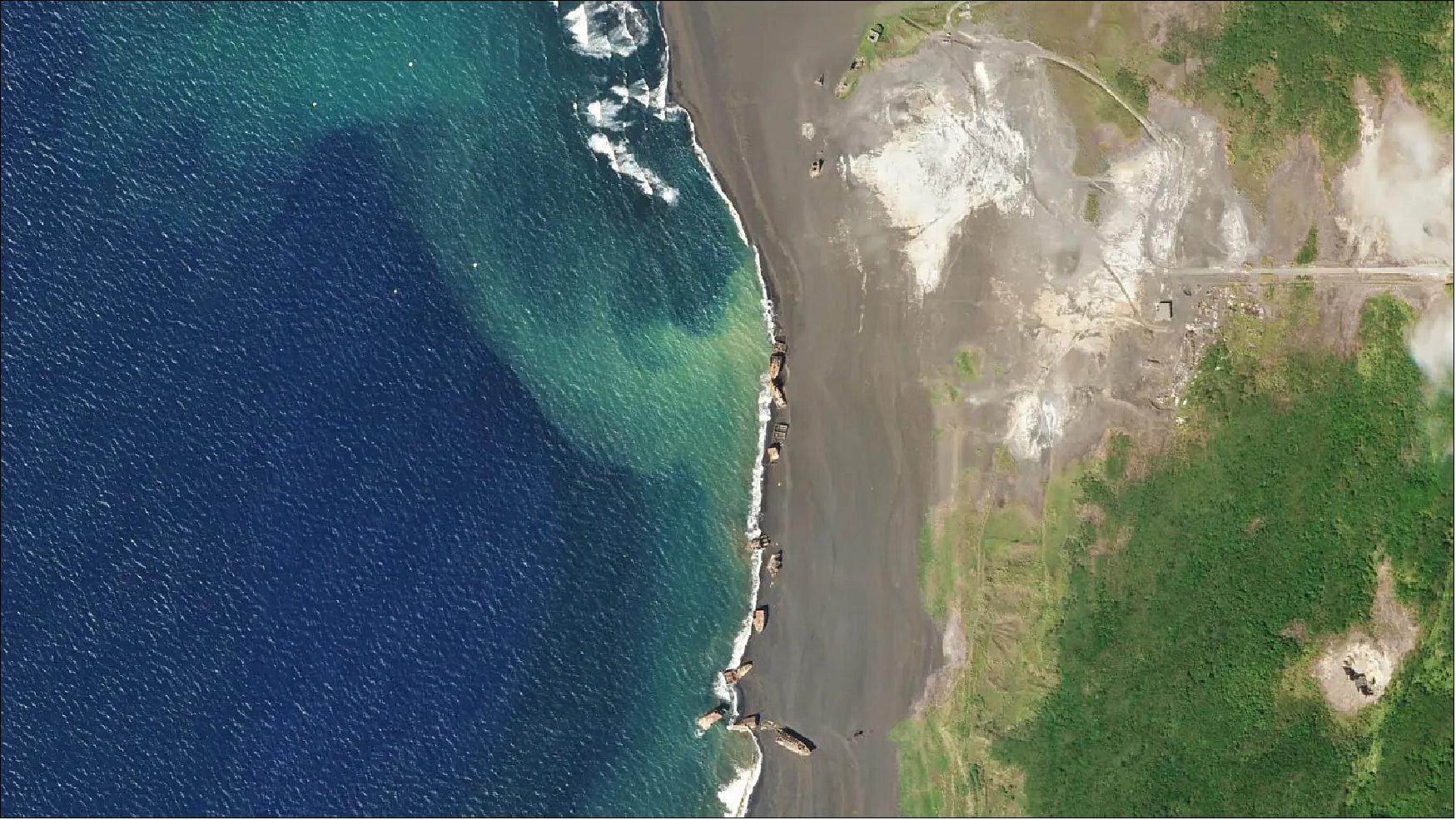
| Measurement detailed | Land surface imagery |
| Instruments | Pelican |
| Instrument type | High resolution optical imagers |
| CEOS EO Handbook | See Planet Pelican summary |
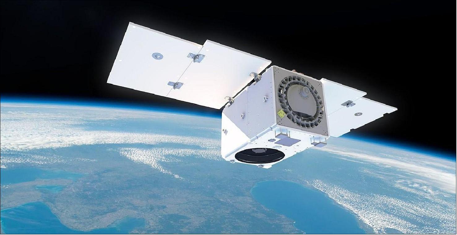
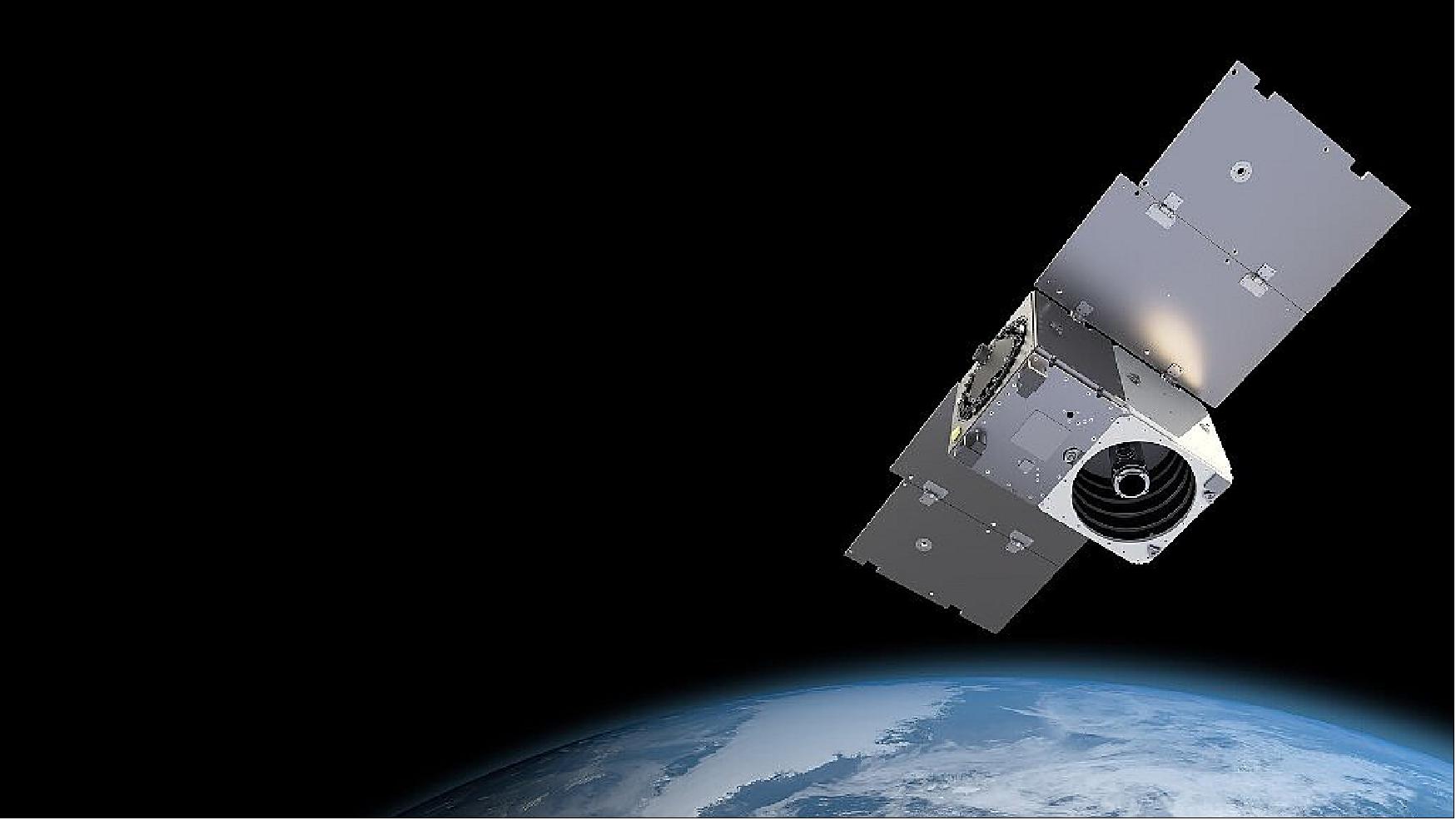
Planet Pelican Satellite Constellation
Development Status References
Overview
In October 2021, Planet Labs of San Francisco unveiled “very high resolution” Pelican Earth-imaging satellites and revealed plans to bring synthetic-aperture radar (SAR) into its Planet Fusion Monitoring data stream. 1)
Planet made the announcements Oct. 12 at the start of Planet Explore 2021, a conference for the company’s customers, partners, developers and data product end users. Company officials declined to comment on the resolution of Pelican satellites, which are scheduled to begin launching in 2022.
Since Pelicans are “designed, built and manufactured” by Planet, they can be upgraded continuously like Dove CubeSats, which are also produced in-house, Robbie Schingler, Planet chief strategy officer, told SpaceNews. Planet has produced 18 generations of Doves.
In contrast, Planet SkySats, which offer 50-centimeter-per-pixel resolution and revisit rates as high as 10 times per day, were manufactured by Maxar Technologies. Planet completed its constellation of 21 SkySats in 2020.
“Pelican significantly advances Planet’s product suite with the highest temporal resolution and revisit times that we have ever offered, while dramatically reducing the time between tasking and receipt of an image,” James Mason, Planet’s senior vice president of space systems, said in a statement. “In a world that is increasingly fast-changing and unpredictable, this kind of detailed information on demand will be a game changer for our customers who every day need to make quick, consequential decisions.”
Planet executives are not revealing the size of the planned Pelican constellation, saying it will largely be determined by market demand.
“If and when the market is there, we can put more satellites in space and we have the ground stations and the ground-processing capability in order to handle more and more data,” Schingler said.
In addition to processing its own imagery, Planet merges imagery from its own flock of 180 Doves with imagery from the European Copernicus Sentinel- 2, NASA’s MODIS (Moderate Resolution Imaging Spectroradiometer) and the U.S. Geological Survey-NASA Landsat to create Planet Fusion Monitoring, a cloud-free data source.
Planet Fusion Monitoring will now include Sentinel-1 SAR data of ESA, which can be acquired at night and through clouds.
“By incorporating SAR into our daily Fusion monitoring product, we ensure direct measurements regardless of cloud cover, providing more insights to our customers to reliably power their decisions,” Planet President Kevin Weil said in a statement.
Planet is creating an “analysis ready data pipeline,” Schingler said. “We’re combining the best of the pixels available to give customers the actual information that they need.”
Over the last two years, Planet engineers have designed two new sensors. One is the hyperspectral sensor for Carbon Mapper satellites to pinpoint, quantify and track sources of methane and carbon dioxide. Pelican’s sensor is the second.
Planet is preparing to go public through a merger with dMY Technology Group, Inc. IV, a special-purpose acquisition company.
Going public will give Planet access to the funds the company needs to “build up the team and build out the Earth data platform,” Schingler said. “As we do more remote sensing science for our users, more people can use it. The more people that use it, the lower cost it is per user. This is how we expand the total addressable market.”
Development Status
• April 20, 2022: It’s another exciting day at Planet (San Francisco) as we unveil details about our next-generation satellite constellation Pelican, designed to efficiently capture brief and rapidly changing events as they unfold! 2)
- The Pelican constellation was designed in-house and is expected to be built at our manufacturing facility in San Francisco. The advancements of this brand new constellation represent a leap forward in capabilities for our customers – from higher revisit and higher spatial resolution, to faster data access and delivery.
- “We are seeing strong and growing demand from multiple market segments for our high resolution products today. We have designed our next generation ‘Pelican’ fleet to meet the evolving needs of customers who want real-time information about global events as they unfold – from floods and wildfires to political conflicts and threats to human rights. Pelican’s rapid response and higher resolution will do exactly that,” said Planet Co-Founder and CEO Will Marshall.
- Pelican is expected to begin launching early next year and to consist of the following specifications:
a) Up to 32 new tasking satellites, which will replenish and improve upon the capabilities of our existing 21 SkySats.
b) Increased rapid revisit, as customers are expected to be able to task images of the same location up to 12 times per day, and will even have 30 opportunities in mid latitudes.
c) Reduced latency for downloading data, creating shorter time loops between tasking and receiving data across the world.
d) Higher resolution capabilities with up to 30 cm resolution imagery.
- This next-generation constellation is expected to monitor patterns of life, like shifting political borders and changing coastlines, and help characterize drivers of environmental change that are threatening protected ecosystems. We hope these exciting product advancements will provide our customers across global industries and governments with the ability to respond to global events with more speed and better informed insights. With such revisit capacity, our users should be able to capture transitory events occuring in one location, increasing their likelihood of obtaining a high quality image even during unpredictable or cloudy weather. These new rapid and accurate insights will be particularly valuable for monitoring regions with fleeting events, like unstable conflict zones or areas vulnerable to storms and fires that spread rapidly over space and time.
- We are currently seeing strong and growing demand from multiple market segments for real-time data from our high-resolution products, including the defense sector for security intelligence, civil government for disaster response, and software companies for mapping platforms. Pelican was designed to meet these growing needs as a state-of-the-art rapid revisit and very high resolution satellite system, delivering information faster and more accurately.
- Our global customers are able to use both of our satellite system products – the PlanetScope monitoring and SkySat tasking – in combination, to execute tip and cue strategies and design automated alert systems. Thus, we designed Pelican to leverage and advance on that interoperability so we can continue to pioneer unique and comprehensive datasets to answer our customers’ questions. Combined with our full suite of daily, global monitoring data and analytics solutions, we believe Pelican will help drive critical decision-making for aid organizations, businesses, international NGOs (Non Government Organizations), and governments.
• November 19, 2021: A decade of history in ~60 words: Planet set out to image and index all of Earth every day. The company developed a constellation of 200 satellites, created the “agile aerospace” assembly method, and built a vast customer base (600+ across 65 countries). Planet now does nine figures in revenue, pulling in $100 M in its last fiscal year. 3)
Let’s run down the key themes from Planet investor day. (NB: talking points are from Planet, not Payload.)
1) Scale: At ~200 satellites, Planet’s constellation is the largest EO fleet to ever exist in LEO. Planet’s birds—literally named Dove, SuperDove, and Pelican—take 3M photos a day.
2) The “one-to-many” model: Sell the same imagery to multiple customers.
3) Speed: Planet has a “multi-year lead” over competing constellation operators.
4) Data advantage: Planet is sitting on a database of 1B+ images. Its satellites have a high cadence revisit. The volume of data—daily Earth scans over time, essentially—is a huge asset for Planet’s AI team. And the value of this data compounds.
5) Defensibility: Planet’s imagery is proprietary, so its platform has sizable switching costs.
6) Lock-in: 90% of customers pay on an annual subscription basis.
- The next chapter: Planet is expanding into new vertical markets. The company also aims to pull off the platform play. It wants to “move up the stack” from proprietary imagery to software analytics layers.
- Payload takeway: Planet is pitching itself a data subscription business with recurring revenue and software-style margins, CEO and cofounder Will Marshall said yesterday.
- Essentially, according to Planet, it’s a SaaS (Software as a Service) business that also makes satellites. If investors agree, Planet could fetch a valuation multiple more on par with software businesses, rather than space players. We’ll find out soon whether investors agree....
• October 12, 2021: Satellite data provider Planet announced Tuesday that it plans to launch a new fleet of orbiting eyes so powerful they can distinguish road markings on the ground. 4)
- Planet, which already operates 200 Earth observation satellites from space, wants to make the new function available in 2023.
- The new satellites, called Pelican, could be used for mapping services, such as Google maps; in environmental tasks, such as spotting illegal forest clearers or observing crops; and in defense to monitor troop movements and airport activity.
- "The data is faster, it's higher resolution, it's lower latency, it's more on demand," Robbie Schingler, a former NASA engineer who co-founded Planet in 2010, told AFP (Agence France-Presse). "It's a whole new satellite."
- The announcement, made at the company's annual conference, underlines the dynamism of the booming nanosatellite market.
- The Pelican satellites could also help support rescue operations, for example by observing the spread of a fire, the company said.
- Planet already has a fleet of 180 satellites, called Dove, which take a picture of the entire planet every day, as well as 21 satellites that can be used to photograph a particular location up to 10 times a day.
- The new fleet is a modernized version of those 21 satellites, which were first launched in 2014 and have a lifespan of five to six years.
- The Pelican satellites, designed and manufactured by Planet, will also feature a reduced lag period between when a photo is taken and when it's sent from the current two hours, Schingler said. "Pelican will be better."
- The Pelican satellites will also be able to take more than the current 10 photographs a day.
- "We're going to launch our first one next year. Then in 2023 (we) launch more of a constellation," Schingler told AFP, adding that the company can deploy "dozens and dozens, even hundreds," of satellites depending on how many contracts it gets.
- Planet also announced a new service that facilitates data processing and interpretation for subscribers.
- Planet currently has around 700 clients, government and private, and produces more than three million images daily.
References
1) Debra Werner, ”Planet unveils Pelican Earth-imaging constellation,” SpaceNews, 12 October 2021, URL: https://spacenews.com/planet-explore-2021-pelicans/
2) ”Our Next-Generation Satellite Constellation Pelican Is Expected to Deliver Very-High-Resolution and Rapid-Revisit Capabilities,” Planet Labs PBC, 20 April 2022, URL: https://www.planet.com/pulse/our-next-generation-satellite-constellation-pelican-is-expected-to-deliver-very-high-resolution-and-rapid-revist-capabilities/
3) Ryan Duffy, ”Planet Investor Day Recap,” Planet, 19 November 2021, URL: https://payloadspace.com/planet-investor-day-recap/
4) ”Planet announces plans for new fleet of Earth observation satellites,” Phys.org News, 12 October 2021, URL: https://phys.org/news/2021-10-planet-fleet-earth-satellites.html
The information compiled and edited in this article was provided by Herbert J. Kramer from his documentation of: ”Observation of the Earth and Its Environment: Survey of Missions and Sensors” (Springer Verlag) as well as many other sources after the publication of the 4th edition in 2002. - Comments and corrections to this article are always welcome for further updates (eoportal@symbios.space).
Development Status References Back to top