SPOT-1,-2,-3
EO
Mission complete
High resolution optical imagers
Land
SPOT-1,-2 and -3 (Satellite pour l'Observation de la Terre) were identical commercial Earth-imaging satellites developed by CNES (Centre National D’Etudes Spatiales), the French Space Agency. They were designed to image land processes and vegetation for monitoring, mapping and planning purposes. The satellites operated between 1986 and 2009.
Quick facts
Overview
| Mission type | EO |
| Agency | CNES |
| Mission status | Mission complete |
| Launch date | 22 Feb 1986 |
| End of life date | 30 Jun 2009 |
| Measurement domain | Land, Snow & Ice |
| Measurement category | Multi-purpose imagery (land), Surface temperature (land), Vegetation, Albedo and reflectance, Landscape topography, Sea ice cover, edge and thickness |
| Measurement detailed | Land surface imagery, Fire temperature, Vegetation type, Fire fractional cover, Earth surface albedo, Land cover, Land surface topography, Iceberg fractional cover, Iceberg height |
| Instruments | DORIS (SPOT), HRV |
| Instrument type | High resolution optical imagers, Precision orbit |
| CEOS EO Handbook | See SPOT-1,-2,-3 summary |
Related Resources

Summary
Mission Capabilities
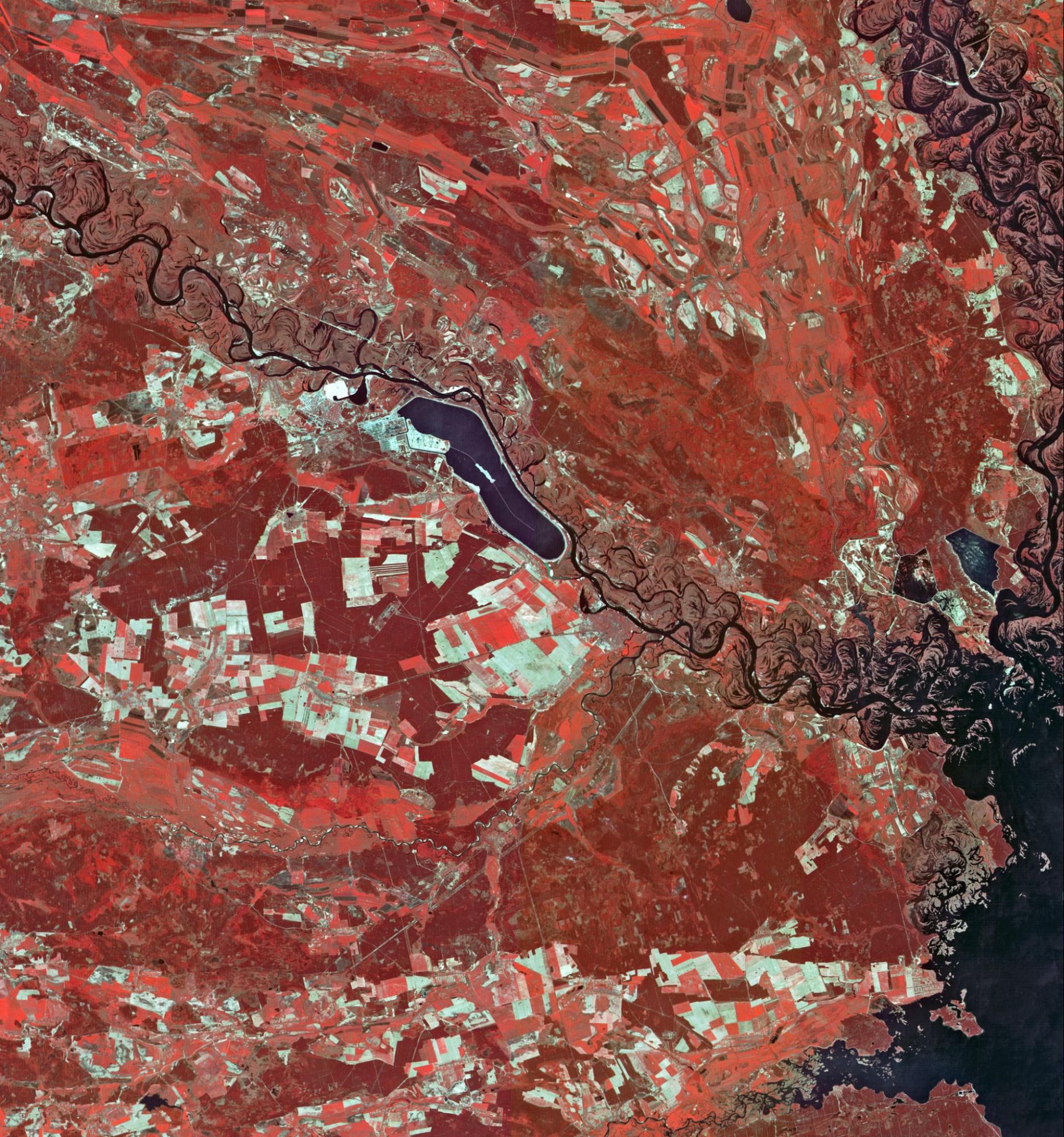
Onboard each satellite were two High-Resolution Visible (HRV) imagers, which were pushbroom sensors. They operated in two modes, Panchromatic (PAN) mode and Multispectral (MS) mode, either individually or simultaneously. HRV was mainly used for land-imagery purposes, with some usage on snow and sea ice cover applications.
Performance Specifications
When used individually, HRV had a swath width of 60 km and field of view of 4.13°. Simultaneous operation yielded a swath width of 117 km with a 3 km overlap. Spatial resolution was provided at 10 m for PAN, with 20 m for MS. HRV imaged in four bands, PAN, Green, Red and Near Infrared (NIR).
SPOT-1, -2 and -3 all operated in sun-synchronous orbits, with an orbit inclination of 98.7°, altitude of 832 km and period of 101 minutes. The repeat cycle was 26 days.
Space and Hardware Components
SPOT-1, -2 and -3 each weighed approximately 1800 kg, and utilised a solar array for power generation. Furthermore, they contained recorders and onboard imaging processing capabilities, with an image telemetry link of 50 Mbit/s at 8 GHz.
The missions were launched in February 1986, January 1990 and September 1993, respectively. SPOT-1 ceased operations in November 2003, while SPOT-2 ceased operations in July 2009. SPOT-3 encountered a malfunction in November 1996, and hence ceased operations.
SPOT-1, -2 and -3 (Satellite Pour l'Observation de la Terre)
Overview
SPOT (Satellite Pour l’Observation de la Terre) is a series of high-resolution optical imaging Earth observation satellites. The series is operated by Spot Image (now European Aeronautic Defence and Space Company (EADSC) - Astrium) 1), based in Toulouse, France. It was initiated in the 1970s by CNES, the French space agency, and was developed in association with Belgium and Sweden. It was designed to improve the knowledge and management of Earth by exploring the planet's resources, detecting and forecasting phenomena involving climatology and oceanography, and monitoring human activities and natural phenomena. 2)
SPOT was developed due to increasing Landsat Data prices in 1984, which made SPOT an economically viable alternative. The series has gone on to include a total of 7 satellites, with SPOT-6 and SPOT-7 remaining operational as of May 2023.
Mission Objectives
The SPOT satellite constellation offered acquisition and daily revisit capacity for anywhere in the world, offering both multispectral and panchromatic images. The multispectral mode used the red, green and infrared bands of the visible spectrum, while the panchromatic mode was a single wide band in the visible part of the spectrum with higher resolution.
The series was utilised for climatology and oceanography detection and forecasting, as well as understanding human activity and natural phenomena. SPOT-1 played a major part in providing imagery of the Chernobyl Nuclear Disaster in April 1986, which was important in assessing the extent of the damage.
Spacecraft
The spacecraft was identical across all three missions, and were three-axis stabilised to 0.1° using momentum wheels. A single solar array generated 1,000 W of power. A hydrazine propulsion system provided orbit maintenance. Overall, the spacecraft weighed 1869 kg, with dimensions of 3.5 m x 15.6 m and a design lifetime of 3 years.
A CNES innovation compared with Landsat was the equipping of the SPOT satellites with steerable mirrors to enable viewing on either side of the ground track, over a 950 km swath, and to acquire imagery from different angles for relief mapping, notably to generate digital terrain models.
The satellite utilised the SPOT Mk1 satellite bus, manufactured by Astrium, which had the capability to communicate downlink at 8 GHz and 2 x 25 Mbps. 2)
Launch
SPOT-1, -2, and -3 were each launched onboard Ariane launch vehicles from Kourou, French Guinea. SPOT-1 was launched on 22 February 1986 onboard an Ariane 1 launch vehicle, while SPOT-2 & -3 were launched on Ariane 40 launch vehicles, on 22 January 1990 and 26 September 1993, respectively. 3)
Orbit: The orbit of all three satellites were identical. The orbit was polar, circular, Sun-synchronous and phased. The inclination of the orbital plane combined with the rotation of Earth around the polar axis allowed the satellites to fly over any point on Earth within 26 days. The orbit had an altitude of 832 km, an inclination of 98.7°, and completed over 14 revolutions per day. 2)
Mission Status
All three satellites are no longer operational.
- 30 Jun 2009 - SPOT-2 deorbiting processes were commenced to bring the orbit altitude of the satellite below 600 km. 4)
- 17 Nov 2003 - SPOT-1 deorbiting processes were commenced at the CNES Space Centre in Toulouse, France after its operational lifetime was completed. 5)
- 14 Nov 1996 - SPOT 3 was relatively short-lived compared with many other satellites in the SPOT series. It was launched in 1993 with an expected lifespan of four years. Failure occurred due to issues with its stabilisation system. 6)
Sensor Complement
High-Resolution Visible (HRV)
Two identical HRV (High Resolution Visible) imaging instruments were found on SPOT 1-3. These operated in either panchromatic or multispectral mode, with a swath width of 60 km. Panchromatic mode provided data at 10 m spatial resolution, whereas multispectral mode provided data at 20 m spatial resolution.
HRV had an oblique viewing capability of 27° on each side of the local vertical. The swath was 117 km2 if both sensors were used simultaneously, with a 3 km2 overlap.
Type | High-resolution optical pushbroom imager | |
Resolution | Panchromatic: 10 m Multispectral: 20 m | |
Swath Width | 60 km | |
Bands | Pan Green Red NIR (Near Infrared) | 0.51-0.73 µm 0.50-0.59 µm 0.61-0.68 µm 0.79-0.89 µm |
Instrument Field of View | 4.13° | |
Ground Sampling Interval (Nadir Viewing) | Panchromatic: 10 m x 10 m Multispectral: 20 m x 20 m | |
Pixels per Line | Panchromatic: 6000 Multispectral: 3000 | |
Swath Width | 60 km | |
Ground Segment
SPOT-1, -2 and -3 utilised CNES’ network of tracking stations at Issus Aussaguel (France), Hartebeesthoek (South Africa), Kerguelen and Kourou (French Guiana). These were supplemented by the ground station in Kiruna, Sweden and the Norwegian ground station in Svalbard. 5)
Data gathered from the SPOT series of satellites are made available for registered users through the ESA Third Party Missions Archive. 2)
References
1) WMO OSCAR Database, “SPOT-2”. URL: https://space.oscar.wmo.int/satellites/view/spot_2
2) ESA Earth Online, “SPOT 1 Overview”. URL: https://earth.esa.int/eogateway/missions/spot-1/description
3) Astronautix, “SPOT-1-2-3”. URL: http://www.astronautix.com/s/spot-1-2-3.html
4) CNES, “SPOT 2 Deorbiting”. URL: https://sciences-techniques.cnes.fr/en/web/CNES-en/10452-st-2009-spot-2-deorbiting.php
5) CNES, “SPOT 1 Deorbiting”. URL: https://cnes.fr/en/web/CNES-en/1624-pr70-2003-de-orbitation-of-spot1.php
6) ESA Earth Online, “SPOT 3 Objectives”. URL: https://earth.esa.int/eogateway/missions/spot-3/objectives
7) ESA Earth Online, “SPOT 1 Objectives”. URL: https://earth.esa.int/eogateway/missions/spot-1