PARASOL (Polarisation and Anisotropy of Reflectances for Atmospheric Science coupled with Observations from a Lidar)
EO
Multiple direction/polarisation radiometers
Atmosphere
Aerosols
PARASOL was a microsatellite with the objective to study the Earth’s atmosphere, including cloud and aerosol properties in climate mechanisms. The PARASOL mission ended in October 2013.
Quick facts
Overview
| Mission type | EO |
| Agency | CNES |
| Mission status | Mission complete |
| Launch date | 18 Dec 2004 |
| End of life date | 11 Oct 2013 |
| Measurement domain | Atmosphere, Land |
| Measurement category | Aerosols, Albedo and reflectance |
| Measurement detailed | Aerosol optical depth (column/profile), Fraction of Absorbed PAR (FAPAR) |
| Instruments | POLDER-P |
| Instrument type | Multiple direction/polarisation radiometers |
| CEOS EO Handbook | See PARASOL (Polarisation and Anisotropy of Reflectances for Atmospheric Science coupled with Observations from a Lidar) summary |
Summary
Mission Capabilities
PARASOL housed POLDER-P (POLarisation and Directionality of the Earth’s Reflectances), a radiometer and polarimeter designed by CNES. The instrument aimed to study the microphysical and radiative properties of clouds and aerosols for model improvement. POLDER-P measured multidirectional and polarised solar radiation reflected by the atmosphere and Earth’s surface, in the visible and near-infrared electromagnetic spectrum (VIS/NIR). PARASOL was a part of the Myriade microsatellite series of CNES and was also a part of NASA’s A-Train (Afternoon Train), a constellation of satellites in-track working together to improve our knowledge of clouds, aerosols, atmospheric chemistry, and other processes related to the Earth’s environment and changing climate.
Performance Specifications
POLDER-P consisted of a digital staring camera with wide FOV (± 43° along track; ± 51° cross track) telecentric optics and a rotating wheel carrying spectral and polarised filters. The instrument had nine spectral channels, three of which were implemented with polarised filters, producing observations across the spectral region of 443 to 910 nm. The radiometric performances of POLDER-P were similar to those of POLDER-1/2 flown on ADEOS and ADEOS-II, respectively. POLDER-P provided a ground spatial resolution of 6 km x 7 km at nadir, with a swath width of 2400 km and a repeat cycle of 16 days.
PARASOL was in a sun-synchronous circular orbit at an altitude of 705 km, inclined at 98.21°. Due to a fuel shortage in 2010, the satellite left the A-Train constellation, continuing its observations from 3.9 km below.
Space and Hardware Components
PARASOL was built on the Myriade bus by CNES, a three-axis stabilised microsatellite, providing a pointing accuracy of 0.1°. Attitude sensing was provided by a star sensor, three sun sensors, a magnetometer, and gyroscopes; actuation was provided by four reaction wheels and three magnetic torquers. RF Communications were provided in S-band frequency with X-band for downlink of payload data.
The mission ended in October 2013, which involved taking PARASOL out of the A-Train constellation zone and then lowering its orbit sufficiently for re-entry into the atmosphere.
PARASOL of CNES Myriade Series
PARASOL (Polarization and Anisotropy of Reflectances for Atmospheric Science coupled with Observations from a Lidar) is a French (CNES) science mission of the Myriade series, put forward by CNRS/LOA [Laboratoire d'Optique Atmosphérique at USTL (Lille University of Science and Technology), Lille, France)], with the general objective to study the Earth's atmosphere. Of particular interest in this study is the role of clouds and aerosols (fine particles in suspension in the air) in climate mechanisms (What effect has global warming had on cloud cover? How do clouds and aerosols interact?).
The PARASOL mission flies the POLDER-derived instrument as its main payload with the objective to improve the microphysical and radiative property characterization of clouds and aerosols for model improvement. Clouds and aerosols play an important role in direct and indirect radiative forcing of the Earth's energy budget. The study of the dynamic processes and interactions between liquid and solid particles (radiative properties of clouds and aerosols) in the atmosphere is therefore a major goal. PARASOL (POLDER) complements CALIPSO (Lidar) and NASA's Aqua and Aura (MODIS, CERES) missions, it also makes use of the CloudSat (CPR) radar data. The instruments form a so-called “train of satellites,” all in the same orbits and in a PM sequence (a loosely-coupled constellation), provide a unique opportunity for near-simultaneous observations, by collecting data in different spectral domains (optical and microwave regions) and at various FOVs (Field of Views). 1) 2) 3)
Spacecraft
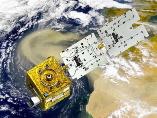
The PARASOL microsatellite of CNES consists of a box-like structure (size: 60 cm x 60 cm x 80 cm) with deployable solar panels (Myriade microsatellite bus). The S/C is three-axis stabilized, providing a pointing accuracy of 0.1º, and a knowledge of 0.02º. Attitude sensing is provided by a star sensor, 3 sun sensors, a magnetometer, and gyros, actuation is provided by 4 reaction wheels and 3 magnetic torquers. The solar power is about 180 W (BOL). The solar array consists of two hinged panels folded against the platform during launch (array length of 1.7 m, triple junction AsGa solar cells are used with an efficiency of 26%, providing 180 W of power). The solar array is articulated for maximum power generation. The Li-ion battery has a capacity of 15 Ah (a commercial product of Sony). Regulation and distribution of power is provided by PCDU (Power Control and Distribution Unit). Orbit control (maintenance) is provided by a blow-down hydrazine system (four 1 N thrusters, using 4.5 kg of hydrazine, Isp of 210 s). The S/C mass is 120 kg at launch, the mission design life is one year with two years as a goal.
OBC: Centralized onboard data handling is provided by a 10 MIPS T805 microprocessor (a radiation-hardened transputer at 15 krad). The OBC power consumption is < 6 W with a mass of 3 kg. Serial asynchronous links are used for onboard data handling.
The PARASOL mission is the second one (after DEMETER) in the Myriade microsatellite series of CNES (see Myriade overview at the end). Myriade also marks the beginning of an innovative partnership between CNES, Alcatel Space and EADS-Astrium. These two companies helped develop the Myriade bus, so they can use the concept for their own missions.
The spacecraft construction was provided mainly in-house. CNES also called on its network of industry partners, including Toulouse-based aero-structures manufacturer Latécoère to assemble and integrate the microsatellite.
Launch
A launch of PARASOL as a secondary payload on Ariane-5G+ from Kourou took place on Dec. 18, 2004. Another secondary payload was NanoSat-1 of INTA, Spain. All secondary payloads (PARASOL, NanoSat-1, and Essaim) used the ASAP (Ariane Structure for Auxiliary Payloads) feature.
The primary payloads on this flight were Helios-2A (launch mass of 4200 kg), a military reconnaissance mission of DGA, France, in partnership with Spain and Belgium (the first satellite in France's second-generation military surveillance system); and four microsatellites called Essaim-1, -2, -3, and -4. Essaim means `swarm' in French, they are also of DGA (Délégation Générale pour l'Armement - French Arms Procurement Agency). The objective is an analysis of the electromagnetic environment (military use). The Essaim satellites use also the Myriade microsatellite bus of CNES.
Orbit: Sun-synchronous circular orbit, altitude = 705 km, inclination = 98.21º, the local equator crossing time is at 13:30. PARASOL will be part of the so-called “A-train” consisting of the Aqua, CloudSat, CALIPSO, PARASOL, and Aura spacecraft.
Note: At the launch of PARASOL, the A-train is consisting of the Aqua (launch 2002) and Aura (launch 2004) spacecraft of NASA. CALIPSO and CloudSat are going to follow in 2005. In addition, the OCO (Orbital Carbon Observatory) minisatellite of NASA was assigned to the A-train, with a planned launch in 2009 (unfortunately, a launch failure of OCO occurred on Feb. 24, 2009).
Communications: A payload mass memory provides a capacity of 16 Gbit. RF communications are provided in S-band (frequency = 2.2 GHz) at a downlink data rate of 400 kbit/s and an uplink rate of 20 kbit/s. In addition, there is an X-band downlink for payload data (8 GHz, 16.8 Mbit/s data rate) with a modulation scheme in QPSK. The communication protocol is in CCSDS standard.
Mission Status
• End of PARASOL mission: On December 18, 2013, exactly 9 years after its launch, CNES shut off the PARASOL satellite. After turning off the payload on October 11, the satellite decommissioning operations took place nominally until PARASOL's last telemetry signal, received at 15:51 UTC on December 18. In 26 years from now, PARASOL should reenter Earth's atmosphere, almost in compliance with the space regulations LOS instructions. The entire acquired data set of PARASOL will be reprocessed in 2014. 4) 5)
The decommissioning took place in three steps:
- The first step was to take PARASOL out of the A-Train constellation zone with no risk to the other satellites on this orbit. This was done between the end of October and the beginning of November thanks to 3 manoeuvres with 2 thrusts each.
- The second step objective was to drain the remaining ergols while lowering the satellite orbit to the maximum in order to reduce the duration of the atmospheric return. This phase named fluidic passivation required 5 manoeuvres with 2 thrusts each and took place in November.
- The third and last step, named electrical passivation, had the objective of shutting off the satellite. It began in early December and ended on December 18, 2013.
• Since October 11, 2013, the end of the PARASOL mission is effective, the satellite operations for decommissioning process are underway and should be finished by the end of December 2013.
• In Q1 2013, the PARASOL mission continues its operations, however at a slightly lower orbit than the A-Train (since November 16, 2011, PARASOL was placed in an orbit 9.5 km under the A-train and continues its nominal mission observing clouds and aerosols).
• On Dec. 18, 2012, the PARASOL mission celebrated 8 years on orbit. Despite some problems with the star tracker, the mission has now an availability near 90%. This anniversary is a little peculiar because it will probably be the last one. Indeed, due to insufficient ergols, the current planning calls for the satellite to be deorbited during the autumn of 2013. Its orbital drift will be too high to ensure the continuation of the mission. 6)
• July 2012: The Parasol project team informs the scientific community and in particular, the users of Parasol data, that the mission local time (1:30 pm at the beginning and approximately up to the end of 2009) is drifting. As the mission has gone on well beyond its expected duration, the inclination of the spacecraft is not maintained for years and now the drift is increasing rapidly into the afternoon. Parasol is currently crossing the equator at approximately 3:00 pm local time. See below a figure that shows the evolution of the local time over the mission duration. This drift does not significantly affect the quality of the products but leads to a sensitive modification of solar geometries during acquisitions. - Furthermore, we remind you that since February 2012 there is no more overlapping at the equator with the other sensors of the A-Train constellation (CNES report as of July 26, 2012, Ref. 6).
• Since November 16, 2011, PARASOL was placed 9.5 km under the A-train and continues its nominal mission observing clouds and aerosols (fuel shortage for constellation maintenance). The measurement continuity is scheduled until the end of September 2013. 7)
• The PARASOL microsatellite and POLDER-P are operating nominally in 2011. On Dec. 18, 2010, PARASOL completed its 6th year on orbit. CNES is considering an extension of the PARASOL mission to cover also the year 2012. 8)
• The PARASOL spacecraft is operating “nominally” in 2010 - however, the mission is not a part of the A-train due to a fuel shortage to execute required manoeuvres. PARASOL will continue to pursue its mission of observing clouds and aerosols.
• PARASOL was moved to a lower orbit (3.9 km below the orbit of the A-train) at 12:48 UT on December 2, 2009. The manoeuvre was performed by the CNES flight operations teams. The microsatellite PARASOL joined the A-train constellation in early February 2005. 9)
Reason: The PARASOL orbit tracks had been slowly drifting eastward during the previous few months, due to insufficient fuel supplies that prevented PARASOL to be part of the last inclination manoeuvre performed by the other A-train satellites in the spring of 2009. However, observations were still in phase with the other sensors. - On the new orbit, observations from PARASOL will no longer be simultaneous with the other sensors, except for only a few days at regular intervals (Ref. 9). 10) 11) 12)
- In September 2009, PARASOL was already preparing to lower its orbit because of depleted propellant resources. The plan was to execute an orbit-lowering manoeuvre on December 2, 2009. Because of the minimal availability of propellant, the collision avoidance manoeuvre had to be kept as small as possible.
- The A-train “control box” is a defined portion of space within which all satellites of the “train” operate. The CNES objective was to ensure that PARASOL would be placed at the extreme rear end of that control box during the upcoming lowering manoeuvre, in order to be as far away as possible from other spacecraft in case of contingency.
- Also, during the A-train period, PARASOL’s Star Tracker (STR) field of view was pointing to the moon during a part of its orbit. Since the STR can not make any measurements when it sees the moon and the STR is the main instrument used to verify the satellite orientation, the standard procedure is to have PARASOL rely on only the gyro measurements. This gyro mode is used only for a few minutes on each rotation but has an impact on the timing of the manoeuvre. In this case, it was not possible to do that manoeuvre exactly on an orbital position opposite to the point of the close approach. If the objective of the manoeuvre was to increase the radial separation between PARASOL and the secondary object (which was the case for the -100 m manoeuvre), then the timing issue made the manoeuvre less efficient.
- Payload operations had to be suspended prior to any manoeuvre, as a rotating wheel inside the payload could change the satellite orientation before the thrusts and degrade the manoeuvre performance (Ref. 11).
• On Dec. 18, 2008, PARASOL was 4 years in orbit.
• The PARASOL spacecraft reached its final 705 km orbit in March 2005 and joined the A-train of NASA flying with Aqua, CALIPSO, CloudSat, and Aura).
• As of April 2005, the spacecraft and its instruments completed the commissioning phase. Important manoeuvres were conducted during the commissioning phase to get into the final operational orbital slot (SSO, 705 km altitude, LTAN of 13:30 hours). Now, the PARASOL orbit control imposes to keep the S/C in a prescribed “box”. The needed manoeuvres are being conducted nearly every month - with the consequence that each time the scientific mission is “off” for two orbits.
• As of fall 2005, PARASOL was set to begin its mission to observe clouds and aerosols in the A-train.
• As of fall 2005, the hydrazine left in the propulsion system is sufficient to maintain station keeping for > 10 years.
• On-orbit operational lessons learnt: The DEMETER operational experience and feedback have permitted us to upload corrections on the PARASOL platform software very soon after its launch (both S/C are of the same family).
Sensor Complement
POLDER-P (Polarization and Directionality of the Earth's Reflectances - PARASOL)
POLDER-P is a CNES instrument (radiometer/polarimeter) of ADEOS and ADEOS-II mission heritage. POLDER-P is an improved version of POLDER1/2, designed at the LOA atmospheric optics laboratory in Lille (CNRS-USTL) and built by EADS-Sodern. The objective is the measurement of multidirectional and polarized solar VIS/NIR radiation reflected by the atmosphere and Earth's surface, and aerosols. POLDER-P consists basically of a digital staring camera composed of a 274 x 242 pixels CCD detection array, wide field-of-view telecentric optics (± 51º cross-track and ± 43º along-track) and of a rotating wheel carrying spectral and polarized filters. 13) 14) 15)
Instrument mass, volume | 32 kg, 0.8 m x 0.5 m x 0.25 m |
Power consumption | 50 W (image mode) |
Data quantization, data rate | 12 bit, 883 kbit/s |
FOV (Field of View) | ± 43º along track; ± 51º cross track |
Swath width | 2400 km |
Ground resolution (at nadir) | 6 km x 7 km |
The sensor concept is based upon the application of polarization filters and measures in a number of spectral bands and at various observation angles (multiangle viewing capability). Compared to POLDER-1/2, the telecentric optics array has been turned 90º to favour multidirectional viewing over daily global coverage. Likewise, a 1020 nm waveband has been added to conduct observations for comparison with data acquired by the lidar on the CALIPSO mission, one of its companion satellites on the A-train. POLDER-P also relies on the innovative techniques developed to calibrate the POLDER1/2 instruments, using in particular the sun's reflection from the ocean surface, clouds and desert areas as targets to validate inflight performance.
A motorized filter wheel enables the successive study of different wavebands of visible light. By adding a band in the near-infrared, POLDER-P expands the spectrum being analyzed and provides an even richer harvest of scientific data.
POLDER has nine spectral channels, three of which are implemented with polarized filters (a total of 15 channels, three channels are needed for each polarized band). The spectral region is from 443 to 910 nm. For the polarized wavelengths, 3 filters measure the linear polarization of the incoming radiation in three directions separated by 120º. The observed data permit the derivation of the Stokes parameters and the total irradiance. The acquisition of an image sequence takes 20 seconds, enabling the observation of one natural target from different directions. The radiometric performances of POLDER-P are similar to those of POLDER-1/2 flown on ADEOS and ADEOS-II, respectively. The vicarious calibration methods, based on the observation of natural targets (no calibration system on board PARASOL), are also the same as those of the POLDER-1/2 instruments.
POLDER-1/2 channels | Bandwidth | POLDER-P channels (band center) | Comments/observations | Saturation level |
443P nm | 20 nm | 444.5 P nm | Polarization moved to 490 nm | 1.1 |
443 nm | 20 nm | 444.9 NP nm (highly dynamic range) | Cloud detection, drop of ocean color applications | 0.97 |
490 nm | 20 nm | 492.2 nm (addition of polarization) | Aerosol retrieval, cloud pressure | 0.75 |
565 nm | 20 nm | 564.5 nm (highly dynamic range) | Lidar at 532 nm | 0.48 |
670P nm | 20 nm | 670.2 P nm (no change) | Aerosol retrieval, cloud properties | 1.1 |
865P nm | 40 nm | 860.8 P nm | Aerosol retrieval, cloud properties | 1.1 |
763 nm | 10 nm | 763.3 nm | Cloud oxygen pressure by differential absorption technique in Oxygen A band | 1.1 |
765 nm | 40 nm | 763.1 nm | 1.1 | |
910 nm | 20 nm | 907.3 nm | Water vapor retrieval | 1.1 |
The saturation levels are given in units of normalized radiance, i.e., the maximum spectral radiance divided by the solar spectral radiance at nadir and multiplied by π. The dynamic reflectance range is subsequently obtained by dividing the range by cos θs, where θs is the solar zenith angle.
A scene (a 2D image) has a size of about 1600 km (along-track) x 2400 km (cross-track) with a ground spatial resolution of 6 km x 7 km at nadir.
Instrument accommodation: POLDER-P has a mass of about 32 kg, a size of about 80 cm x 50 cm x 25 cm, the power consumption = 50 W in imaging mode (mean power of 29 W). The data rate is 883 kbit/s at 12-bit quantization.
Ground Segment
Mission operations and payload data acquisition are being performed at CNES (Myriade Control Center). The MIcrosatellite Ground Segment (MIGS) designed by CNES comprises: 16)
• CCC (Command and Control Center) in Toulouse
• Network of S-band (2 GHz) satellite tracking stations
• Two S-band stations at Aussaguel, near Toulouse, and Kiruna in Sweden providing telemetry/telecommand links
• The TETX (Telemetry Earth Terminal X-band), receiving station in Toulouse for science data reception
• Communication network
• Mission Center in Toulouse
• ICARE Data Processing and Management Center hosted at USTL (Université des Sciences et Techniques de Lille), Lille, France. Note: ICARE is a research structure set up in 2003 on a national level and consisting of CNES, INSU, USTL, etc. (all research laboratories) - to study aerosol-cloud-radiation interactions and the water cycle (cloud properties, atmospheric chemistry) and using data from various missions. 17)
References
1) http://smsc.cnes.fr/PARASOL/index.htm
2) C. Bastien-Thiry, M. Bach, A. Lifermann, “PARASOL a Microsatellite in the A-Train for Earth Atmospheric Observations,” Proceedings of the 5th IAA Symposium on Small Satellites for Earth Observation,” April 4-8, 2005, Berlin, Germany
3) P. Lier, M. Bach, “PARASOL a microsatellite in the A-Train for Earth atmospheric observations,” Proceedings of the 56th IAC 2005, Fukuoda, Japan, Oct. 17-21, 2005, IAC-05-B5.4.03
4) “PARASOL Status,” CNES, Dec. 18, 2013, URL: http://smsc.cnes.fr/PARASOL/
5) “End of Parasol mission,” CNES, Dec. 18, 2013, URL: http://smsc.cnes.fr/PARASOL/GP_actualites.htm
6) “Parasol 8th birthday,” CNES, Dec. 2012, URL: http://smsc.cnes.fr/PARASOL/GP_actualites.htm
7) “PARASOL orbit lowering and mission continuity,” CNES, Nov. 14-16, 2011, URL: http://smsc.cnes.fr/PARASOL/GP_actualites.htm
8) “Parasol satellite mission could be extended,” CNES, January 19, 2011, URL: http://www.cnes.fr/web/CNES-en/9047-gp-parasol-satellite-mission-could-be-extended.php
9) “PARASOL gets off the train,” CNES, Dec. 2, 2009, URL: http://smsc.cnes.fr/PARASOL/GP_actualites.htm
10) Christophe Ferrier, Marco Boschetti, Jean Fourcade, Philippe Gamet, “Exit the A-Train Constellation: PARASOL and CALIPSO different responses,” Proceedings of the SpaceOps 2010 Conference, Huntsville, ALA, USA, April 25-30, 2010, paper: AIAA 2010-2275
11) Christophe Maréchal, Nadège Quéruel, David G. Macdonnell, Carolus A. Verhappen, Patricia L. Lucker, “Flying in a spacecraft constellation: a coordination puzzle,” Proceedings of the SpaceOps 2010 Conference, Huntsville, ALA, USA, April 25-30, 2010, paper: AIAA 2010-2254
12) Bernard Cabrières, Fernand Alby, Christian Cazaux, “Satellite end of life constraints : technical and organisational solutions,” Proceedings of the 61st IAC (International Astronautical Congress), Prague, Czech Republic, Sept. 27-Oct. 1, 2010, IAC-10.B6.2.7
13) “PARASOL - Parasol effect and greenhouse effect,” CNES Dossier, Nov. 2004, pp. 20, http://smsc.cnes.fr/PARASOL/dossier_presse_parasol.pdf
14) F. Bermudo, B. Fougnie, T. Bret Dibat, “POLDER-2 In-Flight Results and PARASOL Perspectives,” Proceedings of the 5th International Conference on Space Optics, March 30- April 2, 2004, Toulouse, France, ESA SP-554
15) C. Bastien Thiry, F. Serene, H. Darnes, F. Duchevet, “DEMETER and PARASOL after 2 years in orbit: where are we?,” Proceedings of the 4S Symposium: `Small Satellite Systems and Services,' Chia Laguna Sardinia, Italy, Sept. 25-29, 2006, ESA SP-618
16) http://smsc.cnes.fr/MYRIADE/GP_segment_sol.htm
17) http://www-icare.univ-lille1.fr/
The information compiled and edited in this article was provided by Herbert J. Kramer from his documentation of: ”Observation of the Earth and Its Environment: Survey of Missions and Sensors” (Springer Verlag) as well as many other sources after the publication of the 4th edition in 2002. - Comments and corrections to this article are always welcome for further updates (eoportal@symbios.space).